|
search place name
|
||
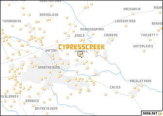
Cypress Creek (South Carolina, United States - USA)Cypress Creek is a town in the South Carolina region of United States - USA. An overview map of the region around Cypress Creek is displayed below.
regional and 3d topo map of Cypress Creek, United States - USA ::
Cypress Creek airports ::
The nearest airport is CLT - Charlotte Douglas Intl, located 88.2 km east of Cypress Creek.
Other airports nearby include AND - Andersen Anderson Rgnl (94.0 km south west), HKY - Hickory Rgnl (95.1 km north east), CAE - Colombia Columbia Metropolitan (134.2 km south east), SSC - Sumter Shaw Afb (170.0 km south east), Nearby towns ::
Zion Hill (0.5km north) //
Hillbrook Forest (1.1km south west) //
Lake Forest (1.3km south) //
Dunagin (1.3km south east) //
Cinder Creek (2.2km south east) //
Pierce Acres (2.5km south east) //
Clearview Heights (2.7km north) //
Springdale (3.3km south) //
Hillcrest (2.9km south west) //
Cherry Hill (2.8km east) //
Southern Pines (2.9km east) //
Farmfields (2.9km west) //
Cannons Camp Ground (3.5km north) //
Converse (3.2km north east) //
Enola (4.1km north) //
Bellview Acres (4.2km north) //
Drayton (3.8km west) //
Bentway Park (4.7km south) //
Country Club Estates (4.8km south) //
Ben Avon (4.8km south) //
Glendale (4.6km south east) //
Lanier Heights (4.2km north west) //
Lawson (4.1km west) //
Quail Hollow (4.9km south) //
Williamsburg Estates (5.2km south) //
Oak Creek (5.3km south) //
Clifton (4.4km east) //
Clifton Station (4.8km north east) //
Calhoun Lake (5.5km south) //
[all distances 'as the bird flies' and approximate] 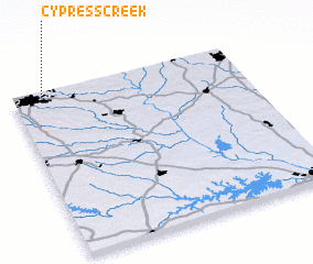 Places with similar names to Cypress Creek, United States - USA ::
// Cypress Creek (US)
// Cypress Creek (US)
// Cypress Creek (US)
// Cypress Creek (US)
// Cypress Creek (US)
// Spears Creek (US)
// Cypress Creek (US)
// Spruce Creek (US)
// Cypress Creek (US)
Disclaimer :: Information on this page comes without warranty of any kind |
||
|
Where is Cypress Creek? Elevation and coordinates ::
Latitude (lat): 34°58'43"N Longitude (lon): 81°52'0"W
Elevation (approx.): 247m (map arrows pan, magnifying glasses zoom) |
||
|
Visiting Cypress Creek? Hotel/Accommodation ::
Book a hotel in Cypress Creek Travel Guide ::
rental cars ::
car rental offers GPS waypoint ::
download a GPX waypoint (PoI) of Cypress Creek for your GPS receiver
|
||