|
search place name
|
||
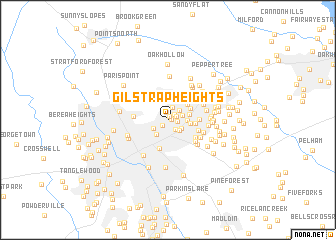
Gilstrap Heights (South Carolina, United States - USA)Gilstrap Heights is a town in the South Carolina region of United States - USA. An overview map of the region around Gilstrap Heights is displayed below.
regional and 3d topo map of Gilstrap Heights, United States - USA ::
Gilstrap Heights airports ::
The nearest airport is AND - Andersen Anderson Rgnl, located 53.6 km south west of Gilstrap Heights.
Other airports nearby include HKY - Hickory Rgnl (130.0 km north east), CLT - Charlotte Douglas Intl (135.0 km east), CAE - Colombia Columbia Metropolitan (155.8 km south east), AGS - Bush Field Augusta Rgnl At Bush Fld (172.5 km south), Nearby towns ::
Forest View (0.3km east) //
North Acres (0.5km north) //
Stone Lake Heights (0.8km south west) //
Pine Knott Forest (0.8km north east) //
Paris (0.9km north east) //
North Side Heights (0.9km east) //
Dellwood (1.3km south east) //
Willow Heights (1.4km north) //
Shady Creek (1.5km north east) //
Wade Hampton Gardens (1.5km east) //
Liberty Park (1.6km south east) //
Green Hills (1.6km south east) //
Northgate (1.6km south west) //
Stone Lake (1.9km south west) //
Bird Fields (1.8km east) //
Piedmont Park (2.3km north) //
Piney Ridge (2.0km east) //
Wildaire (2.1km east) //
Dell Vista Heights (2.7km north) //
Hampton Heights (2.4km north east) //
Minter (2.5km north east) //
Morningside (2.5km east) //
Overbrook (3.3km south) //
Totany Woods (2.9km east) //
Hermitage Hills (3.0km south east) //
Lake Forest (3.2km south east) //
Leawood (3.1km west) //
Timberlake (3.5km south east) //
Spring Forest (3.6km south east) //
[all distances 'as the bird flies' and approximate] 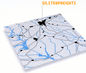 Places with similar names to Gilstrap Heights, United States - USA :: Disclaimer :: Information on this page comes without warranty of any kind |
||
|
Where is Gilstrap Heights? Elevation and coordinates ::
Latitude (lat): 34°53'17"N Longitude (lon): 82°22'9"W
Elevation (approx.): 332m (map arrows pan, magnifying glasses zoom) |
||
|
Visiting Gilstrap Heights? Hotel/Accommodation ::
Book a hotel in Gilstrap Heights Travel Guide ::
rental cars ::
car rental offers GPS waypoint ::
download a GPX waypoint (PoI) of Gilstrap Heights for your GPS receiver
|
||