|
search place name
|
||
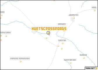
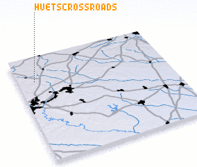
Huets Crossroads (South Carolina, United States - USA)Huets Crossroads is a town in the South Carolina region of United States - USA. An overview map of the region around Huets Crossroads is displayed below.
regional and 3d topo map of Huets Crossroads, United States - USA ::
Huets Crossroads airports ::
The nearest airport is AGS - Bush Field Augusta Rgnl At Bush Fld, located 45.3 km south of Huets Crossroads.
Other airports nearby include CAE - Colombia Columbia Metropolitan (73.4 km east), AND - Andersen Anderson Rgnl (110.3 km north west), SSC - Sumter Shaw Afb (132.9 km east), NBC - Beaufort Mcas (180.1 km south east), Nearby towns ::
 Places with similar names to Huets Crossroads, United States - USA ::
Disclaimer :: Information on this page comes without warranty of any kind |
||
|
Where is Huets Crossroads? Elevation and coordinates ::
Latitude (lat): 33°46'22"N Longitude (lon): 81°53'14"W
Elevation (approx.): 187m (map arrows pan, magnifying glasses zoom) |
||
|
Visiting Huets Crossroads? Hotel/Accommodation ::
Book a hotel in Huets Crossroads Travel Guide ::
rental cars ::
car rental offers GPS waypoint ::
download a GPX waypoint (PoI) of Huets Crossroads for your GPS receiver
|
||