|
search place name
|
||
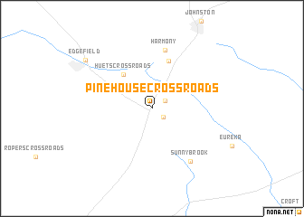
Pine House Crossroads (South Carolina, United States - USA)Pine House Crossroads is a town in the South Carolina region of United States - USA. An overview map of the region around Pine House Crossroads is displayed below.
regional and 3d topo map of Pine House Crossroads, United States - USA ::
Pine House Crossroads airports ::
The nearest airport is AGS - Bush Field Augusta Rgnl At Bush Fld, located 41.8 km south of Pine House Crossroads.
Other airports nearby include CAE - Colombia Columbia Metropolitan (71.8 km east), AND - Andersen Anderson Rgnl (115.3 km north west), SSC - Sumter Shaw Afb (130.9 km east), NBC - Beaufort Mcas (175.0 km south east), Nearby towns ::
Rotalata (1.5km south east) //
Trenton (1.7km north east) //
Parkhill (4.7km north west) //
Huets Crossroads (5.1km north west) //
Bouknight (6.1km north) //
Harmony (7.4km north) //
Sunny Brook (7.6km south east) //
Edgefield (9.1km north west) //
[all distances 'as the bird flies' and approximate] 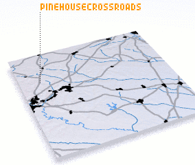 Places with similar names to Pine House Crossroads, United States - USA :: Disclaimer :: Information on this page comes without warranty of any kind |
||
|
Where is Pine House Crossroads? Elevation and coordinates ::
Latitude (lat): 33°44'7"N Longitude (lon): 81°51'21"W
Elevation (approx.): 195m (map arrows pan, magnifying glasses zoom) |
||
|
Visiting Pine House Crossroads? Hotel/Accommodation ::
Book a hotel in Pine House Crossroads Travel Guide ::
rental cars ::
car rental offers GPS waypoint ::
download a GPX waypoint (PoI) of Pine House Crossroads for your GPS receiver
|
||