|
search place name
|
||
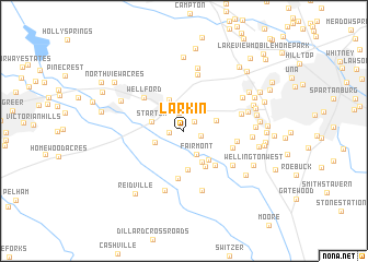
Larkin (South Carolina, United States - USA)Larkin is a town in the South Carolina region of United States - USA. An overview map of the region around Larkin is displayed below.
regional and 3d topo map of Larkin, United States - USA ::
Larkin airports ::
The nearest airport is AND - Andersen Anderson Rgnl, located 75.3 km south west of Larkin.
Other airports nearby include CLT - Charlotte Douglas Intl (107.8 km east), HKY - Hickory Rgnl (110.1 km north east), CAE - Colombia Columbia Metropolitan (139.6 km south east), AGS - Bush Field Augusta Rgnl At Bush Fld (172.2 km south), Nearby towns ::
Fairmont Mills (1.3km north east) //
Brookside Village (1.2km west) //
Cambridge (1.5km east) //
Snoddy (1.8km north) //
Fairmont (2.6km south east) //
Holly Tree (2.7km south west) //
Startex (2.8km west) //
Clevedale (2.9km east) //
Jackson Mill (3.4km north) //
Pinebrook (3.5km south east) //
Brookhaven (3.5km south east) //
Greenridge (4.0km south) //
Pine Grove (4.0km south east) //
Twin Lakes (4.3km south east) //
Water Oaks (4.9km south) //
Lake Ridge (4.4km south east) //
Wellford (4.7km north west) //
Fox Hunt (4.6km east) //
Fort Prince Farms (5.9km north) //
Valley Dale Park (5.4km south east) //
Hadden Heights (5.1km east) //
Poplar Springs (6.2km south) //
Reidville Acres (6.3km south) //
Mount Zion (6.6km north) //
Shoresbrook (5.8km east) //
Forest Park (6.0km north east) //
Cold Spring (5.8km east) //
Lyman (6.1km north west) //
West Forest (6.0km east) //
[all distances 'as the bird flies' and approximate] 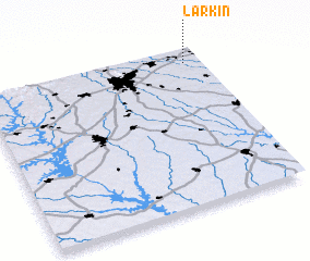 Places with similar names to Larkin, United States - USA ::
// Laragan (PH)
// Lurugan (PH)
// Larkin (US)
// Larkin (US)
// Lürken (DE)
// Larkin (MY)
// La Araucana (CU)
// La Argueña (ES)
// La Raconá (ES)
// Laricano (ES)
Disclaimer :: Information on this page comes without warranty of any kind |
||
|
Where is Larkin? Elevation and coordinates ::
Latitude (lat): 34°55'13"N Longitude (lon): 82°4'11"W
Elevation (approx.): 248m (map arrows pan, magnifying glasses zoom) |
||
|
Visiting Larkin? Hotel/Accommodation ::
Book a hotel in Larkin Travel Guide ::
rental cars ::
car rental offers GPS waypoint ::
download a GPX waypoint (PoI) of Larkin for your GPS receiver
|
||