|
search place name
|
||
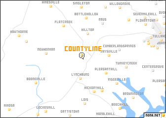
Countyline (Tennessee, United States - USA)Countyline is a town in the Tennessee region of United States - USA. An overview map of the region around Countyline is displayed below.
regional and 3d topo map of Countyline, United States - USA ::
Countyline airports ::
The nearest airport is HUA - Redstone Aaf, located 77.1 km south of Countyline.
Other airports nearby include BNA - Nashville Intl (93.2 km north), CHA - Chattanooga Lovell Fld (110.8 km east), HOP - Hopkinsville Campbell Aaf (180.6 km north west), ANB - Anniston Metro (198.1 km south), Nearby towns ::
Lynchburg (4.5km south) //
Hilltop (5.8km north) //
Raysville (4.8km east) //
Pleasant Hill (5.3km south east) //
Hickory Hill (7.7km south) //
Bakertown (8.0km south east) //
New Herman (6.9km west) //
Cumberland Springs (7.0km east) //
Flat Creek (8.4km north west) //
Raus (8.8km north east) //
Ridgeville (8.3km south east) //
[all distances 'as the bird flies' and approximate] 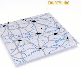 Places with similar names to Countyline, United States - USA ::
// Köndǝlǝn (AZ)
// Caantulan (PH)
// Cantilan (PH)
// Guintoylan (PH)
// Kinudalan (PH)
// County Line (US)
// County Line (US)
// County Line (US)
// County Line (US)
// County Line (US)
Disclaimer :: Information on this page comes without warranty of any kind |
||
|
Where is Countyline? Elevation and coordinates ::
Latitude (lat): 35°19'23"N Longitude (lon): 86°22'8"W
Elevation (approx.): 254m (map arrows pan, magnifying glasses zoom) |
||
|
Visiting Countyline? Hotel/Accommodation ::
Book a hotel in Countyline Travel Guide ::
rental cars ::
car rental offers GPS waypoint ::
download a GPX waypoint (PoI) of Countyline for your GPS receiver
|
||