|
search place name
|
||
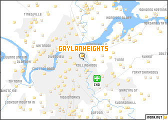
Gaylan Heights (Tennessee, United States - USA)Gaylan Heights is a town in the Tennessee region of United States - USA. An overview map of the region around Gaylan Heights is displayed below.
regional and 3d topo map of Gaylan Heights, United States - USA ::
Gaylan Heights airports ::
The nearest airport is CHA - Chattanooga Lovell Fld, located 4.8 km south east of Gaylan Heights.
Other airports nearby include TYS - Knoxville Mc Ghee Tyson (138.9 km north east), HUA - Redstone Aaf (140.0 km west), MGE - Marietta Dobbins Arb (Atlanta Nas) (144.2 km south east), ANB - Anniston Metro (174.5 km south), Nearby towns ::
Kings Point (2.0km north) //
Cherokee Woods (1.9km east) //
East Chattanooga (1.9km south west) //
Rollingwood (2.4km south) //
Ridgewood Acres (2.6km south west) //
Indian Hills (2.9km south) //
Boyce (2.5km west) //
Eastdale (3.5km south) //
Murray Hills (3.3km north east) //
Avondale (3.4km south west) //
Woodmore (4.0km south) //
Jersey (3.4km east) //
Riverside Park (3.4km west) //
Lake Hills (3.5km east) //
Harbor Heights (3.9km north east) //
Bushtown (4.3km south west) //
Ridgeside (4.9km south west) //
Northshore Estates (5.1km north) //
Lupton City (4.8km north west) //
Fairfax Heights (5.1km north west) //
Shepherd (5.1km south east) //
Rivermont (5.0km north west) //
Glenwood (5.2km south west) //
Hamillville (5.8km north) //
Dale Acres (5.8km north) //
Lake Vista (4.9km east) //
Brainerd (5.9km south) //
Riverview (5.0km west) //
River Hills (5.4km west) //
[all distances 'as the bird flies' and approximate]  Places with similar names to Gaylan Heights, United States - USA ::
// Colony Heights (US)
// Glynn Heights (US)
// Glenn Heights (US)
// Glen Heights (US)
// Calina Heights (US)
// Glenn Heights (US)
Disclaimer :: Information on this page comes without warranty of any kind |
||
|
Where is Gaylan Heights? Elevation and coordinates ::
Latitude (lat): 35°4'22"N Longitude (lon): 85°13'48"W
Elevation (approx.): 267m (map arrows pan, magnifying glasses zoom) |
||
|
Visiting Gaylan Heights? Hotel/Accommodation ::
Book a hotel in Gaylan Heights Travel Guide ::
rental cars ::
car rental offers GPS waypoint ::
download a GPX waypoint (PoI) of Gaylan Heights for your GPS receiver
|
||