|
search place name
|
||
Glenn Heights (Texas, United States - USA)Glenn Heights is a town in the Texas region of United States - USA. An overview map of the region around Glenn Heights is displayed below.
regional and 3d topo map of Glenn Heights, United States - USA ::

Glenn Heights airports ::
The nearest airport is DAL - Dallas Love Fld, located 33.1 km north of Glenn Heights.
Other airports nearby include DFW - Dallas-fort Worth Dallas Fort Worth Intl (42.2 km north west), FTW - Fort Worth Meacham Intl (56.2 km north west), ACT - Waco Rgnl (109.8 km south), TYR - Tyler Pounds Rgnl (138.4 km east), Nearby towns ::
Oak Leaf (3.2km south) //
Ovilla (3.7km south west) //
DeSoto (4.6km north) //
Pleasant Run (6.1km north) //
Shamrock (6.3km north west) //
Red Oak (6.0km south east) //
Elva (6.3km south east) //
Sterrett (8.6km south) //
Pecan Hill (9.6km south east) //
River Oaks (10.1km north west) //
[all distances 'as the bird flies' and approximate] 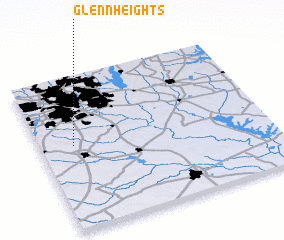 Places with similar names to Glenn Heights, United States - USA ::
// Colony Heights (US)
// Glynn Heights (US)
// Glenn Heights (US)
// Glen Heights (US)
// Calina Heights (US)
// Gaylan Heights (US)
Disclaimer :: Information on this page comes without warranty of any kind |
||
|
Where is Glenn Heights? Elevation and coordinates ::
Latitude (lat): 32°32'55"N Longitude (lon): 96°51'23"W
Elevation (approx.): 208m (map arrows pan, magnifying glasses zoom) |
||
|
Visiting Glenn Heights? Hotel/Accommodation ::
Book a hotel in Glenn Heights Travel Guide ::
rental cars ::
car rental offers GPS waypoint ::
download a GPX waypoint (PoI) of Glenn Heights for your GPS receiver
|
||