|
search place name
|
||
Helton (Tennessee, United States - USA)Helton is a town in the Tennessee region of United States - USA. An overview map of the region around Helton is displayed below.
regional and 3d topo map of Helton, United States - USA ::

Helton airports ::
The nearest airport is TYS - Knoxville Mc Ghee Tyson, located 75.6 km south west of Helton.
Other airports nearby include AND - Andersen Anderson Rgnl (209.0 km south), CHA - Chattanooga Lovell Fld (214.8 km south west), Nearby towns ::
Boggs (2.7km south) //
Hopper Bluff (3.1km south) //
Riverview (2.9km east) //
Big Q Estates (3.3km south west) //
Bowen (3.1km north west) //
Lake Forest Estates (4.3km south) //
Mary Chapel (3.9km east) //
Beans (5.2km north east) //
Rock Haven (5.6km north) //
Avondale (5.8km west) //
Avondale Springs (6.0km west) //
Thorn Hill (7.6km north) //
Tate Springs (7.2km north east) //
Idol (8.3km north) //
Timbercrest (6.9km east) //
Quail Hollow (8.5km south) //
Indian HIlls (7.1km east) //
Wa-Ni Village (9.1km south west) //
Beech Grove (10.4km north west) //
[all distances 'as the bird flies' and approximate] 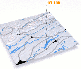 Places with similar names to Helton, United States - USA ::
Disclaimer :: Information on this page comes without warranty of any kind |
||
|
Where is Helton? Elevation and coordinates ::
Latitude (lat): 36°17'31"N Longitude (lon): 83°23'59"W
Elevation (approx.): 387m (map arrows pan, magnifying glasses zoom) |
||
|
Visiting Helton? Hotel/Accommodation ::
Book a hotel in Helton Travel Guide ::
rental cars ::
car rental offers GPS waypoint ::
download a GPX waypoint (PoI) of Helton for your GPS receiver
|
||