|
search place name
|
||
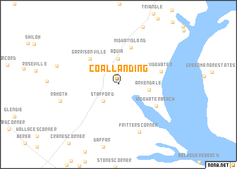
Coal Landing (Virginia, United States - USA)Coal Landing is a town in the Virginia region of United States - USA. An overview map of the region around Coal Landing is displayed below.
regional and 3d topo map of Coal Landing, United States - USA ::
Coal Landing airports ::
The nearest airport is DCA - Ronald Reagan Washington Natl, located 54.4 km north east of Coal Landing.
Other airports nearby include IAD - Washington Dulles Intl (55.7 km north), ADW - Camp Springs Andrews Afb (Washington Dc Naf) (60.7 km north east), NHK - Patuxent River Nas (87.0 km east), BWI - Baltimore Washington Intl (102.2 km north east), Nearby towns ::
Aquia Harbour (1.9km north) //
Stafford (3.3km south west) //
Aquia (4.0km north) //
Arkendale (3.9km east) //
Garrisonville (5.4km north west) //
Midway Island (6.1km north) //
Widewater Beach (5.8km south east) //
Widewater (5.7km east) //
Fritters Corner (8.0km south) //
[all distances 'as the bird flies' and approximate]  Places with similar names to Coal Landing, United States - USA ::
// Koulnatenga (BF)
// Glondong (ID)
// Kalonding (ID)
// Klenteng (ID)
// Gali Ndiang (SN)
// Kolnae-dong (KP)
// Klinting (DK)
// Kilandonnaíika (GR)
Disclaimer :: Information on this page comes without warranty of any kind |
||
|
Where is Coal Landing? Elevation and coordinates ::
Latitude (lat): 38°26'45"N Longitude (lon): 77°23'12"W
Elevation (approx.): 14m (map arrows pan, magnifying glasses zoom) |
||
|
Visiting Coal Landing? Hotel/Accommodation ::
Book a hotel in Coal Landing Travel Guide ::
rental cars ::
car rental offers GPS waypoint ::
download a GPX waypoint (PoI) of Coal Landing for your GPS receiver
|
||