|
search place name
|
||
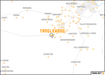
Tanglewood (Virginia, United States - USA)Tanglewood is a town in the Virginia region of United States - USA. An overview map of the region around Tanglewood is displayed below.
regional and 3d topo map of Tanglewood, United States - USA ::
Tanglewood airports ::
The nearest airport is INT - Winston-salem Smith Reynolds, located 154.1 km south west of Tanglewood.
Other airports nearby include RDU - Raleigh-durham Raleigh Durham Intl (163.3 km south), RIC - Richmond Intl (174.8 km east), EKN - Elkins Randolph Co Jennings Randolph (184.1 km north), IAD - Washington Dulles Intl (242.9 km north east), Nearby towns ::
Sandy Acres (0.6km north) //
New London (0.8km north west) //
Wildwood (0.7km east) //
Bedford Springs (1.2km north) //
Federal Hill Estates (2.1km north) //
Closeburn Manor (2.0km north east) //
Fairfields (2.2km east) //
Landmark (3.1km north) //
Timberlake (3.3km north east) //
Windcrest Manor (3.7km north) //
Belmont Acres (3.9km north east) //
Forest Park (4.4km north) //
Hillsman Corner (3.8km north east) //
Nottingham Forest (4.7km north) //
Brush Tavern (4.6km north east) //
Whetstone Hills (4.4km north east) //
Sleepy Hollow (5.0km north) //
Lo Roy Acres (4.4km north east) //
Locust Gardens Mobile Home Park (4.7km north east) //
Woodlawn (4.8km north east) //
Green Meadows (4.6km east) //
Deer Creek (4.9km north east) //
Powhatan (5.5km north east) //
Woodlands (5.7km north) //
Poplar Forest (6.0km north) //
Penn Forest (5.9km north) //
Sunny Banks (5.8km north east) //
Beechwood Hills (5.9km north east) //
Westward Park (6.2km north) //
[all distances 'as the bird flies' and approximate] 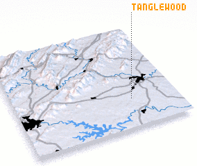 Places with similar names to Tanglewood, United States - USA ::
// Tanglewood (US)
// Dinglewood (US)
// Tanglewood (US)
// Tanglewood (US)
// Tanglewood (US)
// Tanglewood (US)
// Tanglewood (US)
// Tanglewood (US)
// Tanglewood (US)
// Tanglewood (US)
Disclaimer :: Information on this page comes without warranty of any kind |
||
|
Where is Tanglewood? Elevation and coordinates ::
Latitude (lat): 37°17'43"N Longitude (lon): 79°16'35"W
Elevation (approx.): 242m (map arrows pan, magnifying glasses zoom) |
||
|
Visiting Tanglewood? Hotel/Accommodation ::
Book a hotel in Tanglewood Travel Guide ::
rental cars ::
car rental offers GPS waypoint ::
download a GPX waypoint (PoI) of Tanglewood for your GPS receiver
|
||