|
search place name
|
||
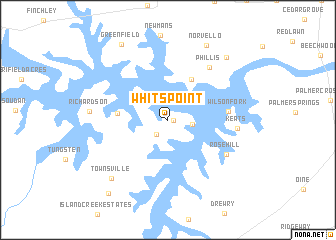
Whits Point (Virginia, United States - USA)Whits Point is a town in the Virginia region of United States - USA. An overview map of the region around Whits Point is displayed below.
regional and 3d topo map of Whits Point, United States - USA ::
Whits Point airports ::
The nearest airport is RDU - Raleigh-durham Raleigh Durham Intl, located 83.9 km south west of Whits Point.
Other airports nearby include GSB - Goldsboro Seymour Johnson Afb (139.5 km south), RIC - Richmond Intl (140.9 km north east), POB - Fayetteville Pope Afb (164.1 km south), INT - Winston-salem Smith Reynolds (172.9 km west), Nearby towns ::
Eppes Fork (0.5km east) //
Woodworth (2.0km south west) //
Presbyterian Point (2.3km east) //
Cusco Willa (5.0km north east) //
Ponderosa (4.5km west) //
Wilson Fork (5.5km east) //
Phillis (7.0km north east) //
Rose Hill (6.5km south east) //
Keats (6.4km east) //
Richardson (7.1km west) //
Townsville (8.2km south west) //
Norvello (9.1km north) //
Castle Heights (8.7km north east) //
Greenfield (9.4km north west) //
Hargrove Estates (9.8km south west) //
[all distances 'as the bird flies' and approximate] 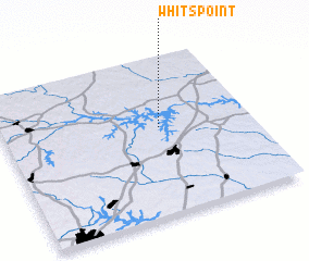 Places with similar names to Whits Point, United States - USA :: Disclaimer :: Information on this page comes without warranty of any kind |
||
|
Where is Whits Point? Elevation and coordinates ::
Latitude (lat): 36°33'10"N Longitude (lon): 78°22'2"W
Elevation (approx.): 120m (map arrows pan, magnifying glasses zoom) |
||
|
Visiting Whits Point? Hotel/Accommodation ::
Book a hotel in Whits Point Travel Guide ::
rental cars ::
car rental offers GPS waypoint ::
download a GPX waypoint (PoI) of Whits Point for your GPS receiver
|
||