|
search place name
|
||
Ấp Ngọn (Sóc Trăng, Vietnam)Ấp Ngọn is a town in the Sóc Trăng region of Vietnam. An overview map of the region around Ấp Ngọn is displayed below.
regional and 3d topo map of Ấp Ngọn, Vietnam ::

Ấp Ngọn airports ::
The nearest airport is SGN - Ho Chi Minh City Tansonnhat Intl, located 176.6 km north east of Ấp Ngọn.
Nearby towns ::
Ấp Trà Chinh (1.0km south east) //
Ấp Ðào Viên (1.3km south west) //
Càu Lịch Tra (1.3km south west) //
Ấp Tân Phước (4.0km south east) //
Ấp Phú Giao (4.3km south west) //
Ấp Tà Mục (4.6km north west) //
Ấp Xẻo Múi (4.7km south) //
Ấp Ngã Bác (5.0km north) //
Thanh Kiết (5.7km north west) //
Ấp Lung Sen (5.8km south east) //
Ấp Kha Chui (5.9km north east) //
Ấp Trà Thăm (6.1km north west) //
Huyện Thạnh Trị (7.1km south west) //
Tuân Tức (7.1km west) //
Ấp Cậu Ba (7.2km north) //
Thạnh Phú (7.6km north east) //
Ấp Tà Tên (2) (7.7km west) //
Ấp Cai Cửu (8.0km west) //
Tuân Tức (8.5km north) //
Ấp Ðáy Ba (8.9km east) //
Ấp Rạch Rừng (9.0km east) //
Ấp Công Ðiền (9.4km south west) //
Ấp Tà Ðiệp (1) (9.7km north west) //
Ấp Thông Lưu (9.8km south east) //
Ấp Tả Biên B (10.6km north east) //
[all distances 'as the bird flies' and approximate] 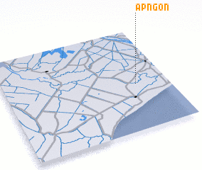 Places with similar names to Ấp Ngọn, Vietnam ::
// Ấp Phú Ngan (VN)
// Ấp Phương An (VN)
Disclaimer :: Information on this page comes without warranty of any kind |
||
|
Where is Ấp Ngọn? Elevation and coordinates ::
Latitude (lat): 9°27'38"N Longitude (lon): 105°48'17"E
Elevation (approx.): 5m (map arrows pan, magnifying glasses zoom) |
||
|
Visiting Ấp Ngọn? Hotel/Accommodation ::
Book a hotel in Ấp Ngọn Travel Guide ::
Buy a travel guide for Vietnam rental cars ::
car rental offers GPS waypoint ::
download a GPX waypoint (PoI) of Ấp Ngọn for your GPS receiver
|
||