|
search place name
|
||
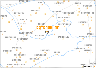
Ấp Tân Phước (Sóc Trăng, Vietnam)Ấp Tân Phước is a town in the Sóc Trăng region of Vietnam. An overview map of the region around Ấp Tân Phước is displayed below.
regional and 3d topo map of Ấp Tân Phước, Vietnam ::
Ấp Tân Phước airports ::
The nearest airport is SGN - Ho Chi Minh City Tansonnhat Intl, located 178.0 km north east of Ấp Tân Phước.
Nearby towns ::
Ấp Lung Sen (2.5km east) //
Ấp Trà Chinh (2.9km north west) //
Ấp Ðào Viên (3.5km north west) //
Càu Lịch Tra (3.5km north west) //
Ấp Xẻo Múi (3.6km south west) //
Ấp Ngọn (4.0km north west) //
Ấp Thông Lưu (6.2km east) //
Ấp Phú Giao (6.3km west) //
Xóm Rạch Rừng (7.0km north east) //
Ấp Kha Chui (7.3km north) //
Xóm Gia Hội (7.4km south) //
Xóm Cây Ngâu (7.6km south) //
Ấp Ngã Bác (7.9km north) //
Ấp Ðáy Ba (8.1km north east) //
Ấp Rạch Rừng (8.3km north east) //
Ấp Tà Mục (8.4km north west) //
Thạnh Phú (8.6km north east) //
Huyện Thạnh Trị (8.6km west) //
Vàm Lẽo (8.8km south east) //
Thanh Kiết (9.6km north west) //
Ấp Trà Thăm (10.0km north west) //
Xóm Rạch Sên (10.9km north east) //
[all distances 'as the bird flies' and approximate] 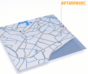 Places with similar names to Ấp Tân Phước, Vietnam ::
Disclaimer :: Information on this page comes without warranty of any kind |
||
|
Where is Ấp Tân Phước? Elevation and coordinates ::
Latitude (lat): 9°25'58"N Longitude (lon): 105°49'38"E
Elevation (approx.): 1m (map arrows pan, magnifying glasses zoom) |
||
|
Visiting Ấp Tân Phước? Hotel/Accommodation ::
Book a hotel in Ấp Tân Phước Travel Guide ::
Buy a travel guide for Vietnam rental cars ::
car rental offers GPS waypoint ::
download a GPX waypoint (PoI) of Ấp Tân Phước for your GPS receiver
|
||