|
search place name
|
||
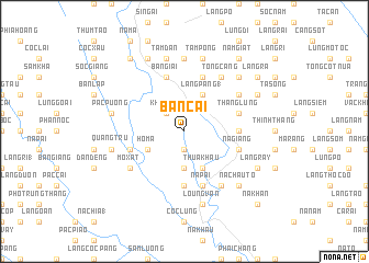
Bản Cai (Cao Bằng, Vietnam)Bản Cai is a town in the Cao Bằng region of Vietnam. An overview map of the region around Bản Cai is displayed below.
regional and 3d topo map of Bản Cai, Vietnam ::
Bản Cai airports ::
The nearest airport is HAN - Hanoi Noibai Intl, located 182.9 km south of Bản Cai.
Nearby towns ::
Ðào Ngạn (1.9km south) //
Khuổi Ma (2.5km north west) //
Nà Phía (3.7km south) //
Hô Mả (3.9km south west) //
Làng Pàng (1) (4.1km north east) //
Thua Khau (4.1km south east) //
Nà Min (5.6km south) //
Nóc Mò (5.1km east) //
Bản Giai (5.8km north) //
Cá Rải (5.8km north) //
Làng Lìn (5.4km west) //
Nà Pài (5.8km south) //
Thang Lủng (5.4km east) //
Nà Giàng (5.4km east) //
Mo Xat (6.3km south west) //
Tổng Cang (6.5km north east) //
Ðông Láng (6.5km south east) //
Keng Củ (6.3km north east) //
Làng Bẩng (7.4km north) //
Tâm Ðan (7.6km north) //
Pàc Puồng (7.1km west) //
Quảng Trù (7.1km west) //
Tàm Pống (7.6km north) //
Loung Van (7.6km south) //
Sông Giang (7.6km north east) //
Nà Chấu Tỏ (7.6km south east) //
Bản Chang (7.6km south east) //
Pá Ràn (8.2km north west) //
Lũng Ða (7.8km north east) //
[all distances 'as the bird flies' and approximate] 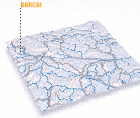 Places with similar names to Bản Cai, Vietnam ::
Disclaimer :: Information on this page comes without warranty of any kind |
||
|
Where is Bản Cai? Elevation and coordinates ::
Latitude (lat): 22°51'0"N Longitude (lon): 106°6'0"E
Elevation (approx.): 366m (map arrows pan, magnifying glasses zoom) |
||
|
Visiting Bản Cai? Hotel/Accommodation ::
Book a hotel in Bản Cai Travel Guide ::
Buy a travel guide for Vietnam rental cars ::
car rental offers GPS waypoint ::
download a GPX waypoint (PoI) of Bản Cai for your GPS receiver
|
||