|
search place name
|
||
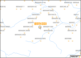
Bản Kỏ Ôi (Vietnam)Bản Kỏ Ôi is a town in Vietnam. An overview map of the region around Bản Kỏ Ôi is displayed below.
regional and 3d topo map of Bản Kỏ Ôi, Vietnam ::
Bản Kỏ Ôi airports ::
The nearest airport is VTE - Vientiane Wattay Intl, located 227.6 km south west of Bản Kỏ Ôi.
Other airports nearby include UTH - Udon Thani (258.8 km south west), HAN - Hanoi Noibai Intl (271.2 km north east), Nearby towns ::
Bản Sôp Thou (3.5km east) //
Bản Ko Phao (4.0km south east) //
Bản Phia Hạ (4.0km north west) //
Bản Phou Côi (5.1km north west) //
Bản Nam Cang (5.2km west) //
Bản Huôi Hốc (5.2km west) //
Bản Púng Xăng (5.6km south) //
Bản Huôi Ki (5.8km north) //
Bản Pa Te (6.6km south west) //
Bản Kou Hat (7.4km north) //
Khê Kiên (7.2km east) //
Bản Huôi Ca Nhó (7.2km west) //
Bản Huôi Cui (7.6km north east) //
Bản Tan Xà (7.6km north east) //
Bản Sop Toc (7.9km north east) //
Bản Nhan Dong (8.2km north east) //
Bản Ca Tang (8.2km north east) //
Bản Sop Huôi Cui (8.9km north east) //
[all distances 'as the bird flies' and approximate] 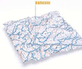 Places with similar names to Bản Kỏ Ôi, Vietnam ::
Disclaimer :: Information on this page comes without warranty of any kind |
||
|
Where is Bản Kỏ Ôi? Elevation and coordinates ::
Latitude (lat): 19°15'0"N Longitude (lon): 104°16'0"E
Elevation (approx.): 663m (map arrows pan, magnifying glasses zoom) |
||
|
Visiting Bản Kỏ Ôi? Hotel/Accommodation ::
Book a hotel in Bản Kỏ Ôi Travel Guide ::
Buy a travel guide for Vietnam rental cars ::
car rental offers GPS waypoint ::
download a GPX waypoint (PoI) of Bản Kỏ Ôi for your GPS receiver
|
||