|
search place name
|
||
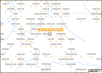
Bản Kouei San (Vietnam)Bản Kouei San is a town in Vietnam. An overview map of the region around Bản Kouei San is displayed below.
regional and 3d topo map of Bản Kouei San, Vietnam ::
Bản Kouei San airports ::
The nearest airport is HAN - Hanoi Noibai Intl, located 217.2 km east of Bản Kouei San.
Nearby towns ::
Bản Nga (1.7km east) //
Bản Kiem (1.7km east) //
Hin Lap (1.9km south) //
Bản Po (1.7km west) //
Ouei Lo (2.5km north west) //
Bản Fuong (2.5km south east) //
Ouei Lôh (3.7km north) //
Bản He Noi (3.4km east) //
Bản Khoai (3.7km south) //
Bản Giang (3.9km north east) //
Ho Na (3.9km south east) //
Bản Lak (3.9km south east) //
Bản Long (3.9km south east) //
Na Ban (3.9km south east) //
Lương Thiện (4.1km south east) //
Ouei Lan (5.1km north east) //
Bản Lan (5.1km north east) //
Than Uyên (5.1km north east) //
Bản Quan (5.1km north west) //
Bản Khoang (5.1km north west) //
Bản Seng (5.1km north west) //
Han Lam (5.1km south east) //
Ouei Louan (5.2km west) //
Bản He Lương (5.2km east) //
Ouei Leup (5.5km west) //
Bản Xao (5.5km west) //
Nà Phát (6.3km north east) //
Mường Mít (6.3km north west) //
Bản Xanh (6.3km north west) //
[all distances 'as the bird flies' and approximate]  Places with similar names to Bản Kouei San, Vietnam ::
// Bancasan (PH)
// Bungsuan (PH)
// Bennigsen (DE)
// Böingsen (DE)
// Bönnigsen (DE)
// Ban Kaeo Saen (TH)
// Ban Kao Son (TH)
// Ban Ko San (TH)
// Benczyn (PL)
// Benacazón (ES)
Disclaimer :: Information on this page comes without warranty of any kind |
||
|
Where is Bản Kouei San? Elevation and coordinates ::
Latitude (lat): 21°58'0"N Longitude (lon): 103°52'0"E
Elevation (approx.): 630m (map arrows pan, magnifying glasses zoom) |
||
|
Visiting Bản Kouei San? Hotel/Accommodation ::
Book a hotel in Bản Kouei San Travel Guide ::
Buy a travel guide for Vietnam rental cars ::
car rental offers GPS waypoint ::
download a GPX waypoint (PoI) of Bản Kouei San for your GPS receiver
|
||