|
search place name
|
||
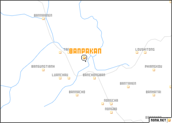
Bản Pa Kan (Lai Châu, Vietnam)Bản Pa Kan is a town in the Lai Châu region of Vietnam. An overview map of the region around Bản Pa Kan is displayed below.
regional and 3d topo map of Bản Pa Kan, Vietnam ::
Bản Pa Kan airports ::
The nearest airport is LPQ - Luang Prabang Luang Phabang Intl, located 242.0 km south west of Bản Pa Kan.
Nearby towns ::
Ta Pao (3.9km north west) //
Bản Chong Ban (4.1km south east) //
Bản Lom (5.1km south west) //
Bản Pa Hon (5.5km west) //
Luân Châu (6.4km south west) //
Bản Na Cho (7.6km south) //
[all distances 'as the bird flies' and approximate]  Places with similar names to Bản Pa Kan, Vietnam ::
// Ban Po Ka Nua (TH)
// Ban Pok Nai (TH)
// Ban Pu Kon (TH)
// Ban Paka Noy (LA)
// Ban Pak-En (LA)
// Ban Pakkôn (LA)
// Ban Pakon (LA)
// Ban Pakouan (LA)
// Ban Pakouay Nua (LA)
// Ban Pak Uon (LA)
Disclaimer :: Information on this page comes without warranty of any kind |
||
|
Where is Bản Pa Kan? Elevation and coordinates ::
Latitude (lat): 21°46'0"N Longitude (lon): 103°22'0"E
Elevation (approx.): 450m (map arrows pan, magnifying glasses zoom) |
||
|
Visiting Bản Pa Kan? Hotel/Accommodation ::
Book a hotel in Bản Pa Kan Travel Guide ::
Buy a travel guide for Vietnam rental cars ::
car rental offers GPS waypoint ::
download a GPX waypoint (PoI) of Bản Pa Kan for your GPS receiver
|
||