|
search place name
|
||
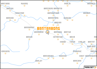
Bản Tam Bong (Vietnam)Bản Tam Bong is a town in Vietnam. An overview map of the region around Bản Tam Bong is displayed below.
regional and 3d topo map of Bản Tam Bong, Vietnam ::
Bản Tam Bong airports ::
The nearest airport is SNO - Sakon Nakhon, located 224.9 km south of Bản Tam Bong.
Other airports nearby include UTH - Udon Thani (277.3 km south west), Nearby towns ::
Bản Hua Na (3.5km west) //
Bản Xá Mú (3.5km east) //
Bản Na Kham (4.0km north west) //
Bản Vàng Mieu (4.1km north east) //
Bản Moi (4.1km north east) //
Xa Tam Thai (4.0km south east) //
Bản Xàn (5.1km north east) //
Bản Na Tăng (5.8km north) //
Khê Bố (6.4km south east) //
Bản Tum (7.0km east) //
Bản Na Phúc (7.2km west) //
Bản Sốp Chon (7.6km north) //
Bản Xai (7.2km west) //
Huôi Côc (8.9km north east) //
[all distances 'as the bird flies' and approximate]  Places with similar names to Bản Tam Bong, Vietnam ::
// Ban Na To Ming (TH)
// Ban Ta Miang (TH)
// Ban Ta Miang (TH)
// Ban Tamnak (TH)
// Ban Tamnak Kao (TH)
// Band-e Amnak (IR)
// Bontomanaik (ID)
// Ban Tambang (LA)
// Ban Tôming (LA)
// Bindamongo (CM)
Disclaimer :: Information on this page comes without warranty of any kind |
||
|
Where is Bản Tam Bong? Elevation and coordinates ::
Latitude (lat): 19°10'0"N Longitude (lon): 104°38'0"E
Elevation (approx.): 128m (map arrows pan, magnifying glasses zoom) |
||
|
Visiting Bản Tam Bong? Hotel/Accommodation ::
Book a hotel in Bản Tam Bong Travel Guide ::
Buy a travel guide for Vietnam rental cars ::
car rental offers GPS waypoint ::
download a GPX waypoint (PoI) of Bản Tam Bong for your GPS receiver
|
||