|
search place name
|
||
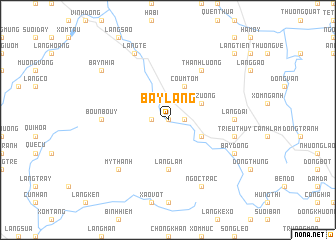
Bay Lang (Vietnam)Bay Lang is a town in Vietnam. An overview map of the region around Bay Lang is displayed below.
regional and 3d topo map of Bay Lang, Vietnam ::
Bay Lang airports ::
The nearest airport is HAN - Hanoi Noibai Intl, located 72.6 km north of Bay Lang.
Nearby towns ::
Bay Chè (0.0km north) //
Làng Giao (1.7km west) //
Sào Dồng (1.7km east) //
Coum Tom (4.1km north east) //
Na Zuong (3.9km north east) //
Douy Bouy (3.9km south east) //
Làng Lâm (5.6km south) //
Tchoue Cay (6.6km north east) //
Thành Lương (6.6km north east) //
Boun Bouy (6.9km west) //
Làng Dai (6.9km east) //
Triều Thủy (7.2km east) //
Mỹ Thành (7.6km south west) //
Bay Dong (7.9km south east) //
Làng Tè (8.2km north west) //
Làng Luông (8.2km south east) //
Ngọc Trạc (8.2km south east) //
Bay Nhia (8.9km north west) //
Ðóng Bươi (10.2km north east) //
Làng Tien (10.2km north east) //
[all distances 'as the bird flies' and approximate] 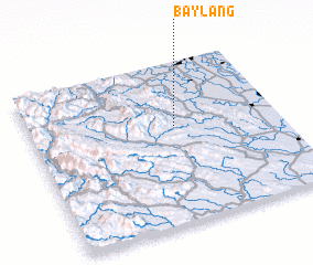 Places with similar names to Bay Lang, Vietnam ::
Disclaimer :: Information on this page comes without warranty of any kind |
||
|
Where is Bay Lang? Elevation and coordinates ::
Latitude (lat): 20°36'0"N Longitude (lon): 105°35'0"E
Elevation (approx.): 36m (map arrows pan, magnifying glasses zoom) |
||
|
Visiting Bay Lang? Hotel/Accommodation ::
Book a hotel in Bay Lang Travel Guide ::
Buy a travel guide for Vietnam rental cars ::
car rental offers GPS waypoint ::
download a GPX waypoint (PoI) of Bay Lang for your GPS receiver
|
||