|
search place name
|
||
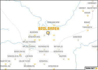
Bro Lâm Peh (Sông Bé, Vietnam)Bro Lâm Peh is a town in the Sông Bé region of Vietnam. An overview map of the region around Bro Lâm Peh is displayed below.
regional and 3d topo map of Bro Lâm Peh, Vietnam ::
Bro Lâm Peh airports ::
The nearest airport is SGN - Ho Chi Minh City Tansonnhat Intl, located 123.3 km south of Bro Lâm Peh.
Other airports nearby include PNH - Phnom-penh Phnom Penh Intl (203.2 km west), Nearby towns ::
Bu Ko Nard Dem (1.8km east) //
Srok Bom Bit (1.8km west) //
Kohor Brết (2.6km south east) //
Srok Bo Dei Moanh (4.1km south west) //
Srok Karan (1) (4.1km north east) //
Bu Keang (5.4km west) //
Srok Pénang (5.7km west) //
Srok Bukal (5.7km west) //
Bu Nho Rung (5.8km south) //
Ấp Tân Lợi (6.6km south east) //
Bu Kamao Kamao (7.3km west) //
Srok Trào (7.6km south) //
Srok Rung (8.3km south east) //
Ấp Lộc Thạnh (1) (8.1km south west) //
Ấp Lộc Thạnh (2) (9.1km south west) //
[all distances 'as the bird flies' and approximate] 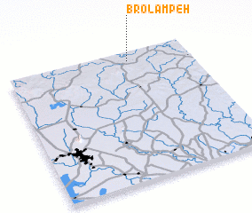 Places with similar names to Bro Lâm Peh, Vietnam :: Disclaimer :: Information on this page comes without warranty of any kind |
||
|
Where is Bro Lâm Peh? Elevation and coordinates ::
Latitude (lat): 11°56'0"N Longitude (lon): 106°40'0"E
Elevation (approx.): 98m (map arrows pan, magnifying glasses zoom) |
||
|
Visiting Bro Lâm Peh? Hotel/Accommodation ::
Book a hotel in Bro Lâm Peh Travel Guide ::
Buy a travel guide for Vietnam rental cars ::
car rental offers GPS waypoint ::
download a GPX waypoint (PoI) of Bro Lâm Peh for your GPS receiver
|
||