|
search place name
|
||
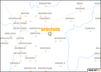
Srok Rung (Sông Bé, Vietnam)Srok Rung is a town in the Sông Bé region of Vietnam. An overview map of the region around Srok Rung is displayed below.
regional and 3d topo map of Srok Rung, Vietnam ::
Srok Rung airports ::
The nearest airport is SGN - Ho Chi Minh City Tansonnhat Intl, located 116.0 km south of Srok Rung.
Other airports nearby include PNH - Phnom-penh Phnom Penh Intl (205.4 km west), Nearby towns ::
Ấp Tân Lợi (1.9km north) //
Bu Rnôm (2.6km south east) //
Ấp Chang Hai (4.1km south east) //
Srok Trào (5.4km west) //
Bu Nho Rung (5.7km west) //
Srok Proai (5.8km south) //
Kohor Brết (5.8km north) //
Srok Phil (6.6km south west) //
Bu Ko Nard Dem (7.6km north) //
Bro Lâm Peh (8.3km north west) //
Srok Bom Bit (9.2km north west) //
Srok Chang Réak (9.2km south west) //
Srok Neir (9.1km north east) //
Srok Bo Dei Moanh (9.1km north west) //
[all distances 'as the bird flies' and approximate] 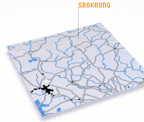 Places with similar names to Srok Rung, Vietnam ::
// Siroka Ornica (CS)
Disclaimer :: Information on this page comes without warranty of any kind |
||
|
Where is Srok Rung? Elevation and coordinates ::
Latitude (lat): 11°52'0"N Longitude (lon): 106°42'0"E
Elevation (approx.): 100m (map arrows pan, magnifying glasses zoom) |
||
|
Visiting Srok Rung? Hotel/Accommodation ::
Book a hotel in Srok Rung Travel Guide ::
Buy a travel guide for Vietnam rental cars ::
car rental offers GPS waypoint ::
download a GPX waypoint (PoI) of Srok Rung for your GPS receiver
|
||