|
search place name
|
||
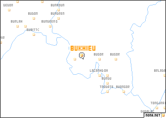
Bu Khiêu (Lâm Ðồng, Vietnam)Bu Khiêu is a town in the Lâm Ðồng region of Vietnam. An overview map of the region around Bu Khiêu is displayed below.
regional and 3d topo map of Bu Khiêu, Vietnam ::
Bu Khiêu airports ::
The nearest airport is SGN - Ho Chi Minh City Tansonnhat Intl, located 112.7 km south west of Bu Khiêu.
Other airports nearby include NHA - Nhatrang (214.7 km east), Nearby towns ::
Bu Dhac (1.8km west) //
Bu Gor (3.6km east) //
La Canh Dom (5.2km south east) //
Bu Pang (6.6km south east) //
Bu Gor (7.3km east) //
Bu R'du (7.8km south east) //
Trodate (9.2km south east) //
Bu N'dreng (10.4km north west) //
[all distances 'as the bird flies' and approximate] 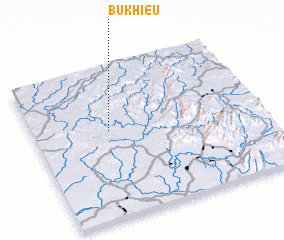 Places with similar names to Bu Khiêu, Vietnam ::
Disclaimer :: Information on this page comes without warranty of any kind |
||
|
Where is Bu Khiêu? Elevation and coordinates ::
Latitude (lat): 11°35'0"N Longitude (lon): 107°20'0"E
Elevation (approx.): 146m (map arrows pan, magnifying glasses zoom) |
||
|
Visiting Bu Khiêu? Hotel/Accommodation ::
Book a hotel in Bu Khiêu Travel Guide ::
Buy a travel guide for Vietnam rental cars ::
car rental offers GPS waypoint ::
download a GPX waypoint (PoI) of Bu Khiêu for your GPS receiver
|
||