|
search place name
|
||
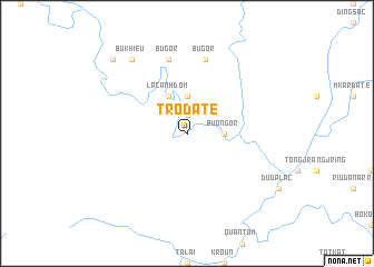
Trodate (Lâm Ðồng, Vietnam)Trodate is a town in the Lâm Ðồng region of Vietnam. An overview map of the region around Trodate is displayed below.
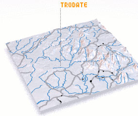
regional and 3d topo map of Trodate, Vietnam ::
Trodate airports ::
The nearest airport is SGN - Ho Chi Minh City Tansonnhat Intl, located 111.1 km south west of Trodate.
Other airports nearby include NHA - Nhatrang (212.2 km east), Nearby towns ::
 Places with similar names to Trodate, Vietnam ::
// Tuora-Tiit (RU)
// Tourtit (MA)
// Torredeita (PT)
// Trædet (NO)
// Dar Titi (TN)
// Douar Douaïdia (TN)
// Douar Douaouda (TN)
// Tardad (ES)
// Dār-e Tūt (IR)
// Dār Tūt (IR)
Disclaimer :: Information on this page comes without warranty of any kind |
||
|
Where is Trodate? Elevation and coordinates ::
Latitude (lat): 11°31'0"N Longitude (lon): 107°23'0"E
Elevation (approx.): 139m (map arrows pan, magnifying glasses zoom) |
||
|
Visiting Trodate? Hotel/Accommodation ::
Book a hotel in Trodate Travel Guide ::
Buy a travel guide for Vietnam rental cars ::
car rental offers GPS waypoint ::
download a GPX waypoint (PoI) of Trodate for your GPS receiver
|
||