|
search place name
|
||
Can Ti (Vietnam)Can Ti is a town in Vietnam. An overview map of the region around Can Ti is displayed below.
regional and 3d topo map of Can Ti, Vietnam ::
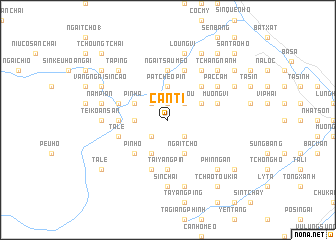
Nearby towns ::
Bản Xèo (1.9km north) //
Pa Téou (2.5km north east) //
Bản Xeo (2.5km north west) //
Cháu Ná (2.5km north east) //
Sin Tchai (2.5km south east) //
Ba Tsiao Pin (2.5km south east) //
Kin Tchang Ho (2.5km south west) //
Pa Cheo (2.5km south east) //
Kan Ti (2.5km south west) //
Nam Poun (3.4km west) //
Pa Tcheo Pin (3.7km north) //
Bản Yang Suoi Tao (3.9km north east) //
Pin Ha (3.9km north west) //
Mường Hum (3.9km north west) //
Naun Poung Ho (4.1km south west) //
Ngai Tcho (4.1km south east) //
Ngài Chồ (4.1km south east) //
Bản Yang Meo (5.0km north east) //
Pin Ho (5.0km south west) //
Nậm Pung (5.6km south) //
Pin Lau (5.1km west) //
Tai Yang Pin (5.6km south) //
Ngai Tsau Meo (5.6km north) //
Na Kin Soui Tao (5.5km east) //
Na Mo (5.5km west) //
Mường Vi (5.5km east) //
Ta Lê (5.5km west) //
Pin Pao (5.5km west) //
Kou Tchou Pin (5.8km south) //
[all distances 'as the bird flies' and approximate] 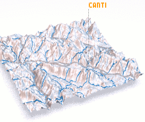 Places with similar names to Can Ti, Vietnam ::
Disclaimer :: Information on this page comes without warranty of any kind |
||
|
Where is Can Ti? Elevation and coordinates ::
Latitude (lat): 22°31'0"N Longitude (lon): 103°45'0"E
Elevation (approx.): 830m (map arrows pan, magnifying glasses zoom) |
||
|
Visiting Can Ti? Hotel/Accommodation ::
Book a hotel in Can Ti Travel Guide ::
Buy a travel guide for Vietnam rental cars ::
car rental offers GPS waypoint ::
download a GPX waypoint (PoI) of Can Ti for your GPS receiver
|
||