|
search place name
|
||
Chung Trai (Lai Châu, Vietnam)Chung Trai is a town in the Lai Châu region of Vietnam. An overview map of the region around Chung Trai is displayed below.
regional and 3d topo map of Chung Trai, Vietnam ::

Nearby towns ::
Pen Po (1.9km south) //
Bản Chung Chải (2.5km south east) //
Tin Pan (2.5km north west) //
Ten Cho (2.5km north west) //
Pu To (2.5km south west) //
Líu Fà Yiền (3.4km west) //
Pà Páo (4.1km north east) //
Pu Pà Páo (4.1km north west) //
Niu Tseang (4.1km south east) //
San Thàu (5.0km north east) //
Ngài Chò (5.0km south east) //
Nam Mạ (5.0km south west) //
Khoang Chù Tsao (5.6km south) //
Ma Lu Thảng (5.1km west) //
Pìn Chải (5.5km west) //
Lao Hu Sung (5.8km north) //
Kin Chu Chung (6.3km north east) //
Nam Cay (6.3km north east) //
Nậm Cum (6.3km north west) //
Nam Sa (6.3km north west) //
Hoi Lung (6.3km south west) //
Ma Quoai Thang (7.6km north) //
Ma Li Pho (7.6km north) //
Po Chu Chung (7.6km north west) //
Bản Năm Cay (7.8km north east) //
Then Sin (8.2km north east) //
Li Sung Quan (7.8km south west) //
Khoang Thèn (8.8km north east) //
Po Ma Ho (9.0km north east) //
[all distances 'as the bird flies' and approximate] 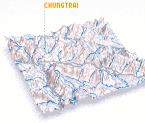 Places with similar names to Chung Trai, Vietnam ::
// Chang Darreh (IR)
// Chhnŏk Tru (KH)
// Changuitiro (MX)
// Chankatyr (UZ)
// Shāh Nikdur (PK)
// Ch'angdae-ri (KP)
// Changdae-ri (KP)
// Changdae-ri (KP)
// Ch'angdo-ri (KP)
// Ch'angt'ae-ri (KP)
Disclaimer :: Information on this page comes without warranty of any kind |
||
|
Where is Chung Trai? Elevation and coordinates ::
Latitude (lat): 22°34'0"N Longitude (lon): 103°13'0"E
Elevation (approx.): 636m (map arrows pan, magnifying glasses zoom) |
||
|
Visiting Chung Trai? Hotel/Accommodation ::
Book a hotel in Chung Trai Travel Guide ::
Buy a travel guide for Vietnam rental cars ::
car rental offers GPS waypoint ::
download a GPX waypoint (PoI) of Chung Trai for your GPS receiver
|
||