|
search place name
|
||
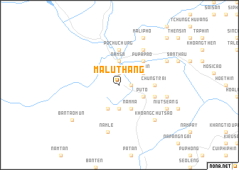
Ma Lu Thảng (Lai Châu, Vietnam)Ma Lu Thảng is a town in the Lai Châu region of Vietnam. An overview map of the region around Ma Lu Thảng is displayed below.
regional and 3d topo map of Ma Lu Thảng, Vietnam ::
Nearby towns ::
Pìn Chải (1.9km north) //
Líu Fà Yiền (1.7km east) //
Nậm Cum (3.7km north) //
Nam Sa (3.7km north) //
Hoi Lung (3.7km south) //
Tin Pan (3.9km north east) //
Ten Cho (3.9km north east) //
Pu To (3.9km south east) //
Nam Mạ (4.1km south east) //
Li Sung Quan (4.1km south west) //
Pu Pà Páo (5.0km north east) //
Po Chu Chung (5.6km north) //
Chung Trai (5.1km east) //
Pen Po (5.5km east) //
Lao Hu Sung (6.5km north east) //
Bản Chung Chải (7.1km east) //
Nam Lé (7.6km south) //
Khoang Chù Tsao (7.6km south east) //
Pà Páo (7.8km north east) //
Ma Li Pho (8.2km north east) //
Niu Tseang (7.8km south east) //
Bản Tao Mún (8.8km south west) //
Ma Quoai Thang (10.1km north east) //
[all distances 'as the bird flies' and approximate]  Places with similar names to Ma Lu Thảng, Vietnam ::
// Multhiang (SD)
// Ma Lú Thang (VN)
Disclaimer :: Information on this page comes without warranty of any kind |
||
|
Where is Ma Lu Thảng? Elevation and coordinates ::
Latitude (lat): 22°34'0"N Longitude (lon): 103°10'0"E
Elevation (approx.): 873m (map arrows pan, magnifying glasses zoom) |
||
|
Visiting Ma Lu Thảng? Hotel/Accommodation ::
Book a hotel in Ma Lu Thảng Travel Guide ::
Buy a travel guide for Vietnam rental cars ::
car rental offers GPS waypoint ::
download a GPX waypoint (PoI) of Ma Lu Thảng for your GPS receiver
|
||