|
search place name
|
||
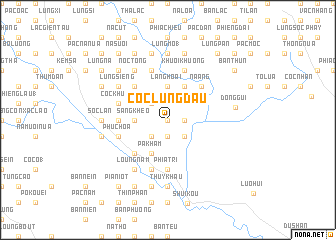
Cốc Lung Ðãu (Cao Bằng, Vietnam)Cốc Lung Ðãu is a town in the Cao Bằng region of Vietnam. An overview map of the region around Cốc Lung Ðãu is displayed below.
regional and 3d topo map of Cốc Lung Ðãu, Vietnam ::
Cốc Lung Ðãu airports ::
The nearest airport is NNG - Nanning Wuxu, located 165.3 km east of Cốc Lung Ðãu.
Other airports nearby include HAN - Hanoi Noibai Intl (166.8 km south west), Nearby towns ::
Lũng Lầu (0.0km north) //
Kouei Y (1.7km east) //
Nà Niêng (1.7km east) //
Bản Sát (1.7km east) //
Pác Liêng (1.7km east) //
Cốc Phường (1.9km south) //
Bản Mấy (2.5km south east) //
Bản Mỏ (2.5km north west) //
Bản Miển (2.5km north west) //
Bản Mầu (2.5km south west) //
Bản Siêng Tẩu (3.7km north) //
Lăng Hoài (3.7km north) //
Sằng Kheo (3.4km west) //
Bản Chu (3.4km west) //
Khuổi Piao (4.1km north east) //
Pa Kham (4.1km south west) //
Bản Nhai (4.1km south west) //
Nà Ang (5.0km north east) //
Cách Linh (5.0km north west) //
Pàc Thọ (5.0km south west) //
Bô Chiểnh (5.0km south west) //
Bó Khoang (5.1km west) //
Phia Trì (5.6km south) //
Khuổi Khuông (5.8km north) //
Cốc Khuất (5.5km west) //
Pác Bó (5.5km west) //
Phục Hòa (5.5km west) //
Bản Mây Mai (5.8km north) //
Co Cao (5.8km south) //
[all distances 'as the bird flies' and approximate] 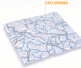 Places with similar names to Cốc Lung Ðãu, Vietnam ::
// Kekulangoda (LK)
Disclaimer :: Information on this page comes without warranty of any kind |
||
|
Where is Cốc Lung Ðãu? Elevation and coordinates ::
Latitude (lat): 22°33'0"N Longitude (lon): 106°34'0"E
Elevation (approx.): 215m (map arrows pan, magnifying glasses zoom) |
||
|
Visiting Cốc Lung Ðãu? Hotel/Accommodation ::
Book a hotel in Cốc Lung Ðãu Travel Guide ::
Buy a travel guide for Vietnam rental cars ::
car rental offers GPS waypoint ::
download a GPX waypoint (PoI) of Cốc Lung Ðãu for your GPS receiver
|
||