|
search place name
|
||
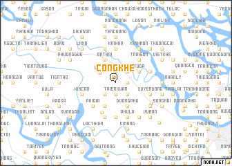
Cống Khê (Hải Hưng, Vietnam)Cống Khê is a town in the Hải Hưng region of Vietnam. An overview map of the region around Cống Khê is displayed below.
regional and 3d topo map of Cống Khê, Vietnam ::
Cống Khê airports ::
The nearest airport is HAN - Hanoi Noibai Intl, located 81.9 km north west of Cống Khê.
Other airports nearby include NNG - Nanning Wuxu (251.3 km north east), Nearby towns ::
Thien Xuan (1.9km south) //
Dông Mỹ (1.9km north) //
Dồng Nhu (1.7km east) //
Hải Ninh (2.5km south west) //
An Phú (2.5km south east) //
Mân Lộc (2.5km north east) //
Cổ Phục (2.5km north east) //
Huyền Tụng (2.5km north east) //
Lễ Dộ (2.9km north west) //
Cẩm La (4.1km south west) //
Khè Phương (4.1km south west) //
Dưỡng Phú (4.1km south east) //
An Thái (4.1km north west) //
Tư Ða (3.9km north east) //
Phì Già (5.1km south west) //
Tông Xá Hạ (5.1km north east) //
Trại Sơn (5.1km north east) //
Ðông Gia (5.2km south west) //
An Lãng (5.6km north) //
Kinh Ha (5.6km north) //
Dĩnh Giang (5.6km south) //
Kim Can (5.5km west) //
Dông Bản (5.8km north) //
Hoàng Xá (5.8km south) //
Xuyên Ðông (5.5km east) //
Tiên Nong (5.5km east) //
Phú La (5.8km south) //
Lưc Nòng (5.5km east) //
Kinh Giao (6.2km south east) //
[all distances 'as the bird flies' and approximate]  Places with similar names to Cống Khê, Vietnam ::
// Kaeng Khoi (TH)
// Cung Khoái (VN)
// Quang Khai (VN)
// Quang Khải (VN)
// Quảng Khê (VN)
// Qingcaohu (CN)
// Kanekawkhi (MM)
// Kaungkha (MM)
Disclaimer :: Information on this page comes without warranty of any kind |
||
|
Where is Cống Khê? Elevation and coordinates ::
Latitude (lat): 20°56'0"N Longitude (lon): 106°32'0"E
Elevation (approx.): 5m (map arrows pan, magnifying glasses zoom) |
||
|
Visiting Cống Khê? Hotel/Accommodation ::
Book a hotel in Cống Khê Travel Guide ::
Buy a travel guide for Vietnam rental cars ::
car rental offers GPS waypoint ::
download a GPX waypoint (PoI) of Cống Khê for your GPS receiver
|
||