|
search place name
|
||
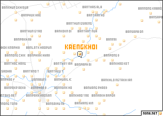
Kaeng Khoi (Sara Buri, Thailand)Kaeng Khoi is a town in the Sara Buri region of Thailand. An overview map of the region around Kaeng Khoi is displayed below.
regional and 3d topo map of Kaeng Khoi, Thailand ::
Kaeng Khoi airports ::
The nearest airport is BKK - Bangkok Intl, located 86.1 km south west of Kaeng Khoi.
Other airports nearby include NAK - Nakhon Ratchasima Khorat (122.0 km east), UTP - Rayong U Taphao Intl (211.1 km south), HHQ - Prachuap Khiri Khan Hua Hin (244.1 km south west), Nearby towns ::
Ban Kaeng Khoi (1.6km east) //
Ban Song Khon Tai (1.8km north west) //
Ban Hua Kaeng (2.0km north east) //
Ban Dong Yang (2.2km west) //
Ban Pa Phai (2.7km south) //
Ban Huai Krabok (3.3km east) //
Ban Muang Tai (3.5km north east) //
Ban Nong Sai (3.8km north west) //
Ban That Tai (3.9km north) //
Ban Tao Pun (4.0km west) //
Ban Si Tha (4.1km west) //
Ban Tha Yiam (4.6km south west) //
Ban Kut Ngong (4.6km south west) //
Ban Lup Lao (4.6km south west) //
Ban Dinso Phong (5.1km east) //
Ban Nong Phak Bung (5.1km east) //
Ban That Nua (5.2km north) //
Ban Nong Bua (2) (5.8km south west) //
Ban Pa (3) (6.0km north east) //
Ban Nong Makha (6.1km north east) //
Ban Kaeng (6.2km south west) //
Ban Kok Noi (6.4km north west) //
Ban Thung Saeng (6.9km north) //
Ban Thap Kwang (1) (6.7km east) //
Ban Tha Tum (7.0km north) //
Ban Pong (1) (6.9km east) //
Ban Phra Phutthabat Mai (7.2km north) //
Ban Takut (7.1km south west) //
Ban Sung Yang (7.1km south west) //
[all distances 'as the bird flies' and approximate] 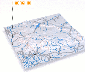 Places with similar names to Kaeng Khoi, Thailand ::
// Cống Khê (VN)
// Cung Khoái (VN)
// Quang Khai (VN)
// Quang Khải (VN)
// Quảng Khê (VN)
// Qingcaohu (CN)
// Kanekawkhi (MM)
// Kaungkha (MM)
Disclaimer :: Information on this page comes without warranty of any kind |
||
|
Where is Kaeng Khoi? Elevation and coordinates ::
Latitude (lat): 14°35'17"N Longitude (lon): 101°0'11"E
Elevation (approx.): 25m (map arrows pan, magnifying glasses zoom) |
||
|
Visiting Kaeng Khoi? Hotel/Accommodation ::
Book a hotel in Kaeng Khoi Travel Guide ::
Buy a travel guide for Thailand rental cars ::
car rental offers GPS waypoint ::
download a GPX waypoint (PoI) of Kaeng Khoi for your GPS receiver
|
||