|
search place name
|
||
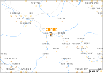
Con Ra (Vietnam)Con Ra is a town in Vietnam. An overview map of the region around Con Ra is displayed below.
regional and 3d topo map of Con Ra, Vietnam ::
Con Ra airports ::
The nearest airport is ZVK - Savannakhet, located 221.1 km south west of Con Ra.
Other airports nearby include DAD - Danang Intl (295.9 km south east), Nearby towns ::
Tùng Nậy (0.0km north) //
Xuân Sơn (1.8km west) //
Ne He (1.8km west) //
Ba Hưng (2.6km south west) //
Xóm Tửa (2.6km north west) //
Xóm Quán (3.5km east) //
Lạc Sơn (4.0km north west) //
Xóm Nước (4.1km south west) //
Xóm Roi (5.6km east) //
Xóm Ấy (5.8km south) //
Hung Sơn (6.5km south east) //
Lạc D (6.6km north east) //
Trại Cày (6.6km north east) //
Xóm Kin (7.6km south) //
Nô Bồ (7.6km south) //
Xóm Côn Si (9.0km north west) //
Mụ U (10.2km north west) //
[all distances 'as the bird flies' and approximate] 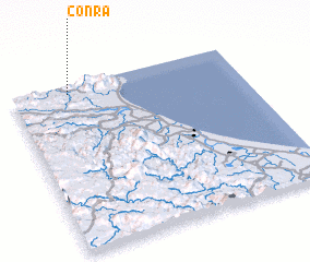 Places with similar names to Con Ra, Vietnam ::
Disclaimer :: Information on this page comes without warranty of any kind |
||
|
Where is Con Ra? Elevation and coordinates ::
Latitude (lat): 17°57'0"N Longitude (lon): 106°15'0"E
Elevation (approx.): 57m (map arrows pan, magnifying glasses zoom) |
||
|
Visiting Con Ra? Hotel/Accommodation ::
Book a hotel in Con Ra Travel Guide ::
Buy a travel guide for Vietnam rental cars ::
car rental offers GPS waypoint ::
download a GPX waypoint (PoI) of Con Ra for your GPS receiver
|
||