|
search place name
|
||
Dại Mõ (Vietnam)Dại Mõ is a town in Vietnam. An overview map of the region around Dại Mõ is displayed below.
regional and 3d topo map of Dại Mõ, Vietnam ::

Dại Mõ airports ::
The nearest airport is HAN - Hanoi Noibai Intl, located 26.7 km north of Dại Mõ.
Nearby towns ::
Hà Ðông (1.6km south east) //
Trung Văn (1.7km east) //
Phú Thú (2.5km north west) //
Triều Khúc (3.5km east) //
Phùng Khoang (3.5km east) //
Kim Lũ (3.5km east) //
Văn La (3.7km south) //
Phú Ðổ (3.7km north) //
La Phù (3.5km west) //
Yên Xá (3.9km south east) //
Yên Lô (4.1km south west) //
Nhân Mỹ (4.1km north east) //
Mễ Trì (4.1km north east) //
Ðinh Thôn (4.1km north east) //
Thượng Thôn (4.1km north west) //
Mậu Lương (5.1km south east) //
Khương Hạ (5.2km east) //
Thanh Quang (5.2km west) //
Phú Mỹ (5.8km north) //
Mai Dich (5.8km north) //
Thanh Liệt (5.5km east) //
Xóm Tren (5.5km east) //
Nhược Công (5.5km east) //
Quan Nhần (5.5km east) //
Vân Lũng (5.5km west) //
Mai Lĩnh (5.8km south) //
Dich Vong Trung (6.5km north east) //
Van Thôn (6.4km south east) //
Phụng Nghia (6.4km south west) //
[all distances 'as the bird flies' and approximate] 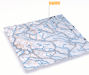 Places with similar names to Dại Mõ, Vietnam ::
Disclaimer :: Information on this page comes without warranty of any kind |
||
|
Where is Dại Mõ? Elevation and coordinates ::
Latitude (lat): 20°59'0"N Longitude (lon): 105°46'0"E
Elevation (approx.): 7m (map arrows pan, magnifying glasses zoom) |
||
|
Visiting Dại Mõ? Hotel/Accommodation ::
Book a hotel in Dại Mõ Travel Guide ::
Buy a travel guide for Vietnam rental cars ::
car rental offers GPS waypoint ::
download a GPX waypoint (PoI) of Dại Mõ for your GPS receiver
|
||