|
search place name
|
||
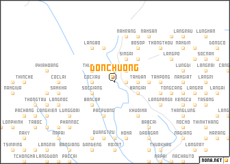
Ðon Chương (Cao Bằng, Vietnam)Ðon Chương is a town in the Cao Bằng region of Vietnam. An overview map of the region around Ðon Chương is displayed below.
regional and 3d topo map of Ðon Chương, Vietnam ::
Ðon Chương airports ::
The nearest airport is HAN - Hanoi Noibai Intl, located 189.4 km south of Ðon Chương.
Nearby towns ::
Nà Kéo (1.9km north) //
Nà Mạ (1.9km north) //
Pá Ràn (1.7km east) //
Làng Luông (2.5km north east) //
Cốc Xâu (3.4km west) //
Tâm Ðan (3.4km east) //
Ngàn Xình (3.9km north west) //
Thum Tao (3.9km north west) //
Cốc Nhu (3.9km north west) //
Sốc Giang (3.9km south west) //
Sí Ngải (4.1km north east) //
Bản Giai (3.9km south east) //
Nam Nhung (5.0km north east) //
Bản Lạp (5.0km south west) //
Bản Cáu (5.0km south west) //
Làng Bẩng (5.1km east) //
Pàc Puồng (5.8km south) //
Bản Hong (5.8km north) //
Làng Bo (6.5km north west) //
Bó Sop (6.5km north east) //
Khuổi Ma (6.5km south east) //
Tàm Pống (6.8km east) //
Nam Rang (7.6km north) //
Choc Mu (7.6km north) //
Cá Rải (7.1km east) //
Cáy Tắc (8.2km north east) //
Làng Pàng (1) (7.8km south east) //
Năm Sấn (9.0km north east) //
Bản Cai (9.0km south east) //
[all distances 'as the bird flies' and approximate]  Places with similar names to Ðon Chương, Vietnam ::
// Dan Chang (TH)
// Danchenki (RU)
// Tunshinga (CD)
// Tanchanaco (MX)
// Tanchanaco (MX)
// Tanchanaco (MX)
// Tancheneque (MX)
// Tunch'ang (KR)
// Da'anchang (CN)
// T'ien-chung (TW)
Disclaimer :: Information on this page comes without warranty of any kind |
||
|
Where is Ðon Chương? Elevation and coordinates ::
Latitude (lat): 22°55'0"N Longitude (lon): 106°3'0"E
Elevation (approx.): 280m (map arrows pan, magnifying glasses zoom) |
||
|
Visiting Ðon Chương? Hotel/Accommodation ::
Book a hotel in Ðon Chương Travel Guide ::
Buy a travel guide for Vietnam rental cars ::
car rental offers GPS waypoint ::
download a GPX waypoint (PoI) of Ðon Chương for your GPS receiver
|
||