|
search place name
|
||
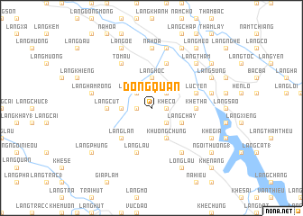
Ðộng Quan (Vietnam)Ðộng Quan is a town in Vietnam. An overview map of the region around Ðộng Quan is displayed below.
regional and 3d topo map of Ðộng Quan, Vietnam ::
Ðộng Quan airports ::
The nearest airport is HAN - Hanoi Noibai Intl, located 153.2 km south east of Ðộng Quan.
Nearby towns ::
Khê Cồ (1.7km east) //
Làng Chang (1.7km west) //
Làng Cô (2.5km south east) //
Khôn Chung (2.5km north east) //
Làng Khương (2.5km north west) //
Làng Chạp (2) (3.4km west) //
Khe Chiêu (3.7km north) //
Làng Hôc (3.7km north) //
Làng Chầy (3.9km south east) //
Câm Kìa (3.9km south east) //
Khuông Chung (4.1km south east) //
Làng Lạn (5.1km south west) //
Khe Tha (5.2km east) //
Làng Cút (5.2km west) //
Làng Mường (5.8km north) //
Lục Yên (5.5km east) //
Làng Lâu (5.8km south) //
Làng Chúc (6.5km south east) //
Tô Mậu (6.5km north west) //
Nà Hòa (7.4km north) //
Làng Nọc (7.6km north) //
Luc An Châu (7.1km east) //
Làng Hàm Rồng (7.1km west) //
Làng Thấm (7.6km north east) //
Long Lâu (8.2km south east) //
Làng Bươm (8.2km north east) //
Khê Già (7.8km south east) //
Làng Ốe (8.2km north west) //
Làng Súng (7.8km north east) //
[all distances 'as the bird flies' and approximate] 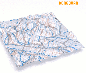 Places with similar names to Ðộng Quan, Vietnam ::
// Duanguican (PH)
// Tangkan (ID)
// Tangkunei (ID)
// Tongkaina (ID)
// Tongkuno (ID)
// Tincocani (PE)
// Tungu Kone (NG)
// Dangougouni (ML)
// Dangakane (PG)
// Tancoigné (FR)
Disclaimer :: Information on this page comes without warranty of any kind |
||
|
Where is Ðộng Quan? Elevation and coordinates ::
Latitude (lat): 22°5'0"N Longitude (lon): 104°39'0"E
Elevation (approx.): 386m (map arrows pan, magnifying glasses zoom) |
||
|
Visiting Ðộng Quan? Hotel/Accommodation ::
Book a hotel in Ðộng Quan Travel Guide ::
Buy a travel guide for Vietnam rental cars ::
car rental offers GPS waypoint ::
download a GPX waypoint (PoI) of Ðộng Quan for your GPS receiver
|
||