|
search place name
|
||
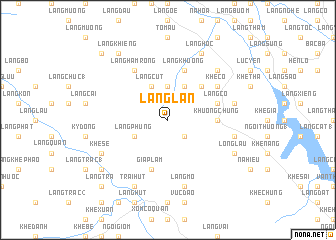
Làng Lạn (Vietnam)Làng Lạn is a town in Vietnam. An overview map of the region around Làng Lạn is displayed below.
regional and 3d topo map of Làng Lạn, Vietnam ::
Làng Lạn airports ::
The nearest airport is HAN - Hanoi Noibai Intl, located 153.7 km south east of Làng Lạn.
Nearby towns ::
Làng Lâu (2.5km south east) //
Làng Chạp (2) (3.7km north) //
Làng Chang (4.1km north east) //
Làng Cút (4.1km north west) //
Làng Phung (3.9km south west) //
Ðộng Quan (5.1km north east) //
Khuông Chung (5.2km east) //
Làng Khương (5.8km north) //
Làng Cô (5.5km east) //
Giáp Lẫm (5.8km south) //
Khê Cồ (6.3km north east) //
Làng Hàm Rồng (6.5km north west) //
Câm Kìa (7.1km east) //
Làng Chầy (7.1km east) //
Làng Chúc (7.1km east) //
Làng Mo (7.6km south) //
Khôn Chung (7.6km north east) //
Long Lâu (7.8km south east) //
Khê Sẻ (7.8km south west) //
Làng Hôc (8.2km north east) //
Khe Chiêu (8.2km north east) //
Trại Hút (8.2km south west) //
Làng Khiêng (9.0km north west) //
Làng Chò (1) (8.8km south west) //
Khê Chê (10.1km south west) //
Làng Trà (10.1km south west) //
Làng Chi Nơc (10.1km north west) //
[all distances 'as the bird flies' and approximate] 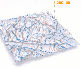 Places with similar names to Làng Lạn, Vietnam ::
Disclaimer :: Information on this page comes without warranty of any kind |
||
|
Where is Làng Lạn? Elevation and coordinates ::
Latitude (lat): 22°3'0"N Longitude (lon): 104°37'0"E
Elevation (approx.): 529m (map arrows pan, magnifying glasses zoom) |
||
|
Visiting Làng Lạn? Hotel/Accommodation ::
Book a hotel in Làng Lạn Travel Guide ::
Buy a travel guide for Vietnam rental cars ::
car rental offers GPS waypoint ::
download a GPX waypoint (PoI) of Làng Lạn for your GPS receiver
|
||