|
search place name
|
||
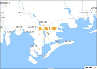
Ðong Thon (Quảng Ninh, Vietnam)Ðong Thon is a town in the Quảng Ninh region of Vietnam. An overview map of the region around Ðong Thon is displayed below.
regional and 3d topo map of Ðong Thon, Vietnam ::
Ðong Thon airports ::
The nearest airport is NNG - Nanning Wuxu, located 122.4 km north of Ðong Thon.
Nearby towns ::
Chuc Tchia (1.7km west) //
Ho Viêt (1.9km south) //
Xuân Lạn Nam (1.9km south) //
Móng Cái (2.5km north west) //
Sec Kep (2.5km south west) //
San Cap (2.5km north east) //
Lục Lâm (2.5km north east) //
Long Kiềng (3.4km west) //
Qua Phố (3.9km north west) //
Dongxing (4.1km north west) //
Trà Cổ (5.1km south east) //
Slein Hao Lan (5.5km west) //
Nam Thon (6.5km south west) //
San Choc Si (6.9km west) //
Ðoan Tĩnh (6.9km west) //
Vàn Ninh (7.6km south west) //
Sa Vi Xom (7.8km south east) //
[all distances 'as the bird flies' and approximate] 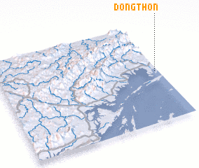 Places with similar names to Ðong Thon, Vietnam ::
// Ðảng Thôn (VN)
// Dang Thon (VN)
// Ðông Than (VN)
// Ðông Thàn (VN)
// Ðông Thanh (VN)
// Ðông Thanh (VN)
// Ðông Thanh (VN)
// Ðông Thạnh (VN)
// Ðồng Thành (VN)
// Ðồng Thành (VN)
Disclaimer :: Information on this page comes without warranty of any kind |
||
|
Where is Ðong Thon? Elevation and coordinates ::
Latitude (lat): 21°31'0"N Longitude (lon): 107°59'0"E
Elevation (approx.): 3m (map arrows pan, magnifying glasses zoom) |
||
|
Visiting Ðong Thon? Hotel/Accommodation ::
Book a hotel in Ðong Thon Travel Guide ::
Buy a travel guide for Vietnam rental cars ::
car rental offers GPS waypoint ::
download a GPX waypoint (PoI) of Ðong Thon for your GPS receiver
|
||