|
search place name
|
||
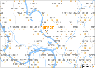
Ðức Bác (Vĩnh Phú, Vietnam)Ðức Bác is a town in the Vĩnh Phú region of Vietnam. An overview map of the region around Ðức Bác is displayed below.
regional and 3d topo map of Ðức Bác, Vietnam ::
Ðức Bác airports ::
The nearest airport is HAN - Hanoi Noibai Intl, located 43.0 km east of Ðức Bác.
Nearby towns ::
Phương Lan (1.7km west) //
Xóm Khéu (1.9km south) //
Dương Thọ (2.5km north west) //
An Lão (2.5km north west) //
Vính Quế (2.5km south west) //
Làng Tiên Cát (3.7km south) //
Vân Lung (3.5km west) //
Yên Lập (4.1km north west) //
Phiên Dư (3.9km south east) //
Yên Tĩnh (5.1km north east) //
Quan Tư (5.1km south east) //
Minh Nông (5.1km south west) //
Nhu Sơn (5.6km north) //
Phú Nặng (5.2km west) //
Sơn Bình (1) (5.2km east) //
Việt Trì (5.5km south) //
Nội Mỹ (5.8km north) //
Phù Ðức (5.5km west) //
Xuân Lôi (5.5km east) //
Hương Nghĩa (5.5km east) //
Lập Thạch (6.5km north east) //
Bạch Hạc (6.5km south east) //
Ðại Dệ (6.9km east) //
Ðông Ðạo (7.4km north) //
Chiểu Ðương (7.4km south) //
Tiên Lữ (7.1km east) //
Bình Sơn (7.6km north) //
Tử Ðà (7.6km north) //
Bình Bộ (7.6km north) //
[all distances 'as the bird flies' and approximate] 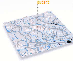 Places with similar names to Ðức Bác, Vietnam ::
// Dagubek (PH)
// Dağbağ (TR)
// Dukubaka (GH)
// Digobuke (TZ)
// Dāki Baihk (PK)
// Doga Baihk (PK)
// Digabougou (ML)
// Dokabougou (ML)
// Dokobougou (ML)
// Tigabougou (ML)
Disclaimer :: Information on this page comes without warranty of any kind |
||
|
Where is Ðức Bác? Elevation and coordinates ::
Latitude (lat): 21°21'0"N Longitude (lon): 105°25'0"E
Elevation (approx.): 15m (map arrows pan, magnifying glasses zoom) |
||
|
Visiting Ðức Bác? Hotel/Accommodation ::
Book a hotel in Ðức Bác Travel Guide ::
Buy a travel guide for Vietnam rental cars ::
car rental offers GPS waypoint ::
download a GPX waypoint (PoI) of Ðức Bác for your GPS receiver
|
||