|
search place name
|
||
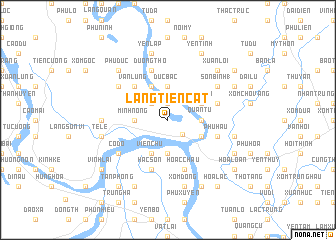
Làng Tiên Cát (Vĩnh Phú, Vietnam)Làng Tiên Cát is a town in the Vĩnh Phú region of Vietnam. An overview map of the region around Làng Tiên Cát is displayed below.
regional and 3d topo map of Làng Tiên Cát, Vietnam ::
Làng Tiên Cát airports ::
The nearest airport is HAN - Hanoi Noibai Intl, located 41.9 km east of Làng Tiên Cát.
Nearby towns ::
Xóm Khéu (1.9km north) //
Việt Trì (2.2km south east) //
Vính Quế (2.5km north west) //
Ðức Bác (3.7km north) //
Quan Tư (3.5km east) //
Minh Nông (3.5km west) //
Chiểu Ðương (3.7km south) //
Phiên Dư (3.9km north east) //
Phương Lan (4.1km north west) //
Bạch Hạc (3.9km south east) //
Viên Chu (4.1km south west) //
Vân Lung (5.1km north west) //
Hoac Châu (5.8km south) //
Hương Nghĩa (5.5km east) //
An Lão (5.8km north) //
Dương Thọ (5.8km north) //
Hạc Sơn (5.8km south) //
Phú Hậu (5.5km east) //
Phú Nặng (6.4km north west) //
Sơn Bình (1) (6.4km north east) //
Cổ Ðộ (6.4km south west) //
Làng Thụy Vận (6.9km west) //
Yên Lập (7.6km north) //
Hạ Chuế (7.2km east) //
Xóm Ðòng (7.6km south) //
Tề Lễ (7.2km west) //
Phù Ðức (7.6km north west) //
Xuân Lôi (7.6km north east) //
Yên Tĩnh (8.2km north east) //
[all distances 'as the bird flies' and approximate] 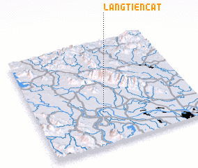 Places with similar names to Làng Tiên Cát, Vietnam ::
// Làng Ðiên Cat (VN)
Disclaimer :: Information on this page comes without warranty of any kind |
||
|
Where is Làng Tiên Cát? Elevation and coordinates ::
Latitude (lat): 21°19'0"N Longitude (lon): 105°25'0"E
Elevation (approx.): 15m (map arrows pan, magnifying glasses zoom) |
||
|
Visiting Làng Tiên Cát? Hotel/Accommodation ::
Book a hotel in Làng Tiên Cát Travel Guide ::
Buy a travel guide for Vietnam rental cars ::
car rental offers GPS waypoint ::
download a GPX waypoint (PoI) of Làng Tiên Cát for your GPS receiver
|
||