|
search place name
|
||
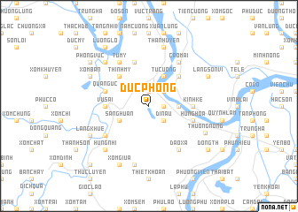
Ðức Phong (Vĩnh Phú, Vietnam)Ðức Phong is a town in the Vĩnh Phú region of Vietnam. An overview map of the region around Ðức Phong is displayed below.
regional and 3d topo map of Ðức Phong, Vietnam ::
Ðức Phong airports ::
The nearest airport is HAN - Hanoi Noibai Intl, located 58.1 km east of Ðức Phong.
Nearby towns ::
Xóm Bãi (1.9km north) //
Hương Nộn (1.7km east) //
Bồng Lãng (2.5km north east) //
Dị Nậu (2.5km south east) //
Hữu Bổ Thượng (3.5km east) //
Sang Huân (3.9km south west) //
Tự Cường (4.1km north east) //
Thịnh Mỹ (5.1km north west) //
Lãng Hồ (5.1km north east) //
Tề Lé (5.2km west) //
Bản Nguyên (5.2km east) //
Kinh Kệ (5.2km east) //
Vù Sái (5.2km west) //
Quang Uc (5.5km west) //
Hưng Hóa (5.5km east) //
Cỏ Tiết (5.8km north) //
Ðào Xá (6.5km south east) //
Tứ Mỹ (6.5km north west) //
Cao Mại (6.5km north east) //
Hung Vĩ (6.4km south west) //
Thanh Uyên (7.6km north) //
Phú Cường (1) (7.6km north) //
Giáp Lai (7.6km south) //
Thượng Nông (7.4km south east) //
Hùng Nhĩ (7.6km south west) //
My Hạ (7.6km north west) //
Xóm Giua (8.2km south west) //
Xóm Ban (7.8km north west) //
Làng Sơn Vi (7.8km north east) //
[all distances 'as the bird flies' and approximate] 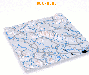 Places with similar names to Ðức Phong, Vietnam ::
// Tikhvinka (RU)
// Tikhvinka (RU)
// Tikhvinka (RU)
// Tikhvinka (RU)
// Tikhvinka (RU)
// Tikhvinka (RU)
// Dougoufing (ML)
// Dak Vên (2) (VN)
// Ðức Phong (VN)
// Duc Phong (VN)
Disclaimer :: Information on this page comes without warranty of any kind |
||
|
Where is Ðức Phong? Elevation and coordinates ::
Latitude (lat): 21°16'0"N Longitude (lon): 105°15'0"E
Elevation (approx.): 45m (map arrows pan, magnifying glasses zoom) |
||
|
Visiting Ðức Phong? Hotel/Accommodation ::
Book a hotel in Ðức Phong Travel Guide ::
Buy a travel guide for Vietnam rental cars ::
car rental offers GPS waypoint ::
download a GPX waypoint (PoI) of Ðức Phong for your GPS receiver
|
||