|
search place name
|
||
Ðức Phong (Bình Phước, Vietnam)Ðức Phong is a town in the Bình Phước region of Vietnam. An overview map of the region around Ðức Phong is displayed below.
regional and 3d topo map of Ðức Phong, Vietnam ::

Ðức Phong airports ::
The nearest airport is SGN - Ho Chi Minh City Tansonnhat Intl, located 126.7 km south west of Ðức Phong.
Other airports nearby include NHA - Nhatrang (216.7 km east), Nearby towns ::
Bu Môn (1) (0.0km north) //
Vĩnh Thiện (2.6km south west) //
Srok Bramang (2.6km north west) //
Bu Bolon (3.6km west) //
Bu Lon (2) (4.1km south east) //
Bu Dăng (2) (4.1km north east) //
Bu Siett (4.1km south west) //
Bu Coh (1) (5.6km south) //
Bu Ban (5.7km west) //
Bu Roum (6.6km north east) //
Bu T'chop (6.6km south east) //
Bu Tom (6.6km south west) //
Bu Ló (7.4km north) //
Bu Coh (2) (7.4km south) //
Buôn Dang (7.5km east) //
Bu Sar (7.6km south) //
Bu Croi (8.1km south west) //
Bu Nhai (8.1km south west) //
Bu Lô (9.2km north east) //
Poul Bri (1) (9.1km north east) //
Bon Bu T'chop (10.4km south east) //
[all distances 'as the bird flies' and approximate] 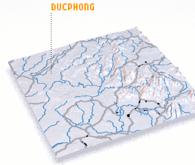 Places with similar names to Ðức Phong, Vietnam ::
// Tikhvinka (RU)
// Tikhvinka (RU)
// Tikhvinka (RU)
// Tikhvinka (RU)
// Tikhvinka (RU)
// Tikhvinka (RU)
// Dougoufing (ML)
// Dak Vên (2) (VN)
// Ðức Phong (VN)
// Duc Phong (VN)
Disclaimer :: Information on this page comes without warranty of any kind |
||
|
Where is Ðức Phong? Elevation and coordinates ::
Latitude (lat): 11°48'0"N Longitude (lon): 107°15'0"E
Elevation (approx.): 264m (map arrows pan, magnifying glasses zoom) |
||
|
Visiting Ðức Phong? Hotel/Accommodation ::
Book a hotel in Ðức Phong Travel Guide ::
Buy a travel guide for Vietnam rental cars ::
car rental offers GPS waypoint ::
download a GPX waypoint (PoI) of Ðức Phong for your GPS receiver
|
||