|
search place name
|
||
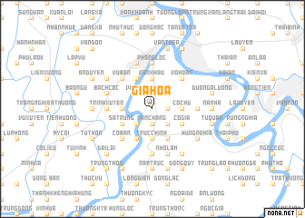
Gia Hòa (Vietnam)Gia Hòa is a town in Vietnam. An overview map of the region around Gia Hòa is displayed below.
regional and 3d topo map of Gia Hòa, Vietnam ::
Gia Hòa airports ::
The nearest airport is HAN - Hanoi Noibai Intl, located 102.4 km north of Gia Hòa.
Nearby towns ::
Vẩn Chàng (1.9km south) //
Bai Trach Ha (1.9km south) //
Báo Ðáp (1.7km east) //
Vân Ðôn (2.5km north west) //
Tân Cốc (2.5km north west) //
Ðại An (2.5km north west) //
An Thuy (2.5km south west) //
Ngưu Trì (2.5km south east) //
Quả Linh (3.5km west) //
Thượng Hữu (3.7km north) //
Vân Khẫu (3.7km north) //
Ðồng Vân (3.7km north) //
Trực Chính (3.7km south) //
Cổ Chử (3.5km east) //
Lông Dông (4.1km north west) //
Sa Trung (3.9km south west) //
Thi Liệu (4.1km south west) //
Nguyệt My (4.1km south west) //
Cổ Tung (4.1km south east) //
Cổ Gia (3.9km south east) //
Vu Bản (5.1km north west) //
Cố Bản (5.1km south west) //
Vô Hoạn (5.1km north east) //
Lã Diên (5.1km north east) //
Dương Lai (5.2km west) //
Trịnh Xuyên (5.2km west) //
Cao Lộng (5.2km east) //
Phong Lộc (5.6km north) //
Hiệp Luật (5.6km south) //
[all distances 'as the bird flies' and approximate]  Places with similar names to Gia Hòa, Vietnam ::
Disclaimer :: Information on this page comes without warranty of any kind |
||
|
Where is Gia Hòa? Elevation and coordinates ::
Latitude (lat): 20°22'0"N Longitude (lon): 106°11'0"E
Elevation (approx.): 5m (map arrows pan, magnifying glasses zoom) |
||
|
Visiting Gia Hòa? Hotel/Accommodation ::
Book a hotel in Gia Hòa Travel Guide ::
Buy a travel guide for Vietnam rental cars ::
car rental offers GPS waypoint ::
download a GPX waypoint (PoI) of Gia Hòa for your GPS receiver
|
||