|
search place name
|
||
Giang Trò To (Lai Châu, Vietnam)Giang Trò To is a town in the Lai Châu region of Vietnam. An overview map of the region around Giang Trò To is displayed below.
regional and 3d topo map of Giang Trò To, Vietnam ::
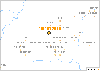
Nearby towns ::
Lo Quan Chai (1.9km north) //
Nằm Phủng Hò (3.7km south) //
Lò Quan Chải (3.7km north) //
Giàng Mưng Pho (3.9km south east) //
À Pé Ló Tè (5.0km north east) //
Nằm Phủng Hò Mo Pý (5.8km south) //
Tả Phìn Chang (5.5km east) //
Sa Kha (6.5km north east) //
Mou Tieng (6.3km south east) //
Chang Si Chải (6.3km south west) //
Nam Pei Ho (7.6km south) //
Lossa (7.6km south east) //
Sen Thương (8.2km south east) //
[all distances 'as the bird flies' and approximate] 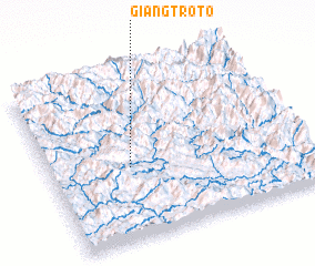 Places with similar names to Giang Trò To, Vietnam :: Disclaimer :: Information on this page comes without warranty of any kind |
||
|
Where is Giang Trò To? Elevation and coordinates ::
Latitude (lat): 22°26'0"N Longitude (lon): 102°19'0"E
Elevation (approx.): 984m (map arrows pan, magnifying glasses zoom) |
||
|
Visiting Giang Trò To? Hotel/Accommodation ::
Book a hotel in Giang Trò To Travel Guide ::
Buy a travel guide for Vietnam rental cars ::
car rental offers GPS waypoint ::
download a GPX waypoint (PoI) of Giang Trò To for your GPS receiver
|
||