|
search place name
|
||
Lossa (Lai Châu, Vietnam)Lossa is a town in the Lai Châu region of Vietnam. An overview map of the region around Lossa is displayed below.
regional and 3d topo map of Lossa, Vietnam ::
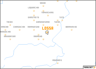
Nearby towns ::
Mou Tieng (1.9km north) //
Sen Thương (2.5km south west) //
Nằm Phủng Hò Mo Pý (3.4km west) //
Nam Pei Ho (3.9km south west) //
Giàng Mưng Pho (4.1km north west) //
Tù Cha (5.0km north east) //
Nằm Phủng Hò (5.5km west) //
San Sả Hò (6.5km north east) //
Tả Phìn Chang (7.4km north) //
Giang Trò To (7.6km north west) //
Tô So Dón (7.6km north east) //
Tù Tờ (7.6km north east) //
Lo Quan Chai (9.0km north west) //
[all distances 'as the bird flies' and approximate] 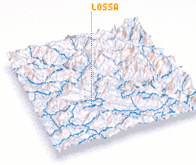 Places with similar names to Lossa, Vietnam ::
Disclaimer :: Information on this page comes without warranty of any kind |
||
|
Where is Lossa? Elevation and coordinates ::
Latitude (lat): 22°23'0"N Longitude (lon): 102°22'0"E
Elevation (approx.): 702m (map arrows pan, magnifying glasses zoom) |
||
|
Visiting Lossa? Hotel/Accommodation ::
Book a hotel in Lossa Travel Guide ::
Buy a travel guide for Vietnam rental cars ::
car rental offers GPS waypoint ::
download a GPX waypoint (PoI) of Lossa for your GPS receiver
|
||