|
search place name
|
||
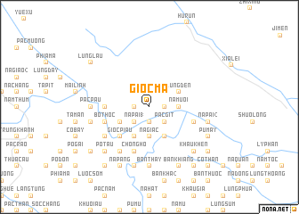
Giổc Mạ (Cao Bằng, Vietnam)Giổc Mạ is a town in the Cao Bằng region of Vietnam. An overview map of the region around Giổc Mạ is displayed below.
regional and 3d topo map of Giổc Mạ, Vietnam ::
Giổc Mạ airports ::
The nearest airport is NNG - Nanning Wuxu, located 157.3 km east of Giổc Mạ.
Other airports nearby include HAN - Hanoi Noibai Intl (202.7 km south west), Nearby towns ::
Giổc Rinh (1.7km east) //
Lũng Oảt (1.7km west) //
Kéo Hiền (1.9km south) //
Pác Gịt (2.5km south east) //
Nà Ay (2.5km south east) //
Nà Pài (1) (2.5km south west) //
Nà Mười (3.4km east) //
Bản Củn (3.4km east) //
Bản Giủc (3.4km east) //
Na Giac (3.7km south) //
Lũng Den (3.9km north east) //
Bản Cải (4.1km south east) //
Lũng Nám (3.9km south west) //
Nà Ai (4.1km south west) //
Bản Khầy (4.1km south west) //
Giổc Piẩu (5.0km south west) //
Bản Chang (4) (5.1km west) //
Chổng Hó (5.8km south) //
Bó Thốc (5.4km west) //
Lũng Niêo (5.4km east) //
Nà Tuông (6.5km south west) //
Bản Ruôc (6.3km south west) //
Bản Thay (7.4km south) //
Pác Pầu (6.8km west) //
Chi Choi (6.8km west) //
Nà Pài (2) (7.1km east) //
Bản Bóng Tẩu (7.6km south) //
Pác Cọn (7.1km west) //
Pò Tâu (7.6km south west) //
[all distances 'as the bird flies' and approximate] 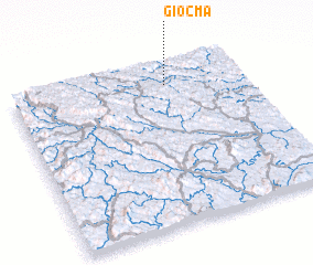 Places with similar names to Giổc Mạ, Vietnam ::
Disclaimer :: Information on this page comes without warranty of any kind |
||
|
Where is Giổc Mạ? Elevation and coordinates ::
Latitude (lat): 22°52'0"N Longitude (lon): 106°40'0"E
Elevation (approx.): 449m (map arrows pan, magnifying glasses zoom) |
||
|
Visiting Giổc Mạ? Hotel/Accommodation ::
Book a hotel in Giổc Mạ Travel Guide ::
Buy a travel guide for Vietnam rental cars ::
car rental offers GPS waypoint ::
download a GPX waypoint (PoI) of Giổc Mạ for your GPS receiver
|
||