|
search place name
|
||
Giồng Nhum (Vietnam)Giồng Nhum is a town in Vietnam. An overview map of the region around Giồng Nhum is displayed below.
regional and 3d topo map of Giồng Nhum, Vietnam ::

Giồng Nhum airports ::
The nearest airport is SGN - Ho Chi Minh City Tansonnhat Intl, located 138.3 km north of Giồng Nhum.
Other airports nearby include PNH - Phnom-penh Phnom Penh Intl (261.6 km north west), Nearby towns ::
Giồng Ðinh (1.8km east) //
Giồng Cà Hom (2.0km north) //
Ấp Cá Lóc (3.4km south east) //
Ấp Giữa (4.0km north) //
Giồng Dàm Rai (4.1km north east) //
Xóm Bà Keo (4.9km south west) //
Xóm Xoài Rùm (5.3km north west) //
Ấp Chợ (5.9km north) //
Xóm Rạch Lớn (5.8km west) //
Trà Cú (6.2km north) //
Giồng Cây Ða (6.3km east) //
Giồng Hàm Giang (6.6km north east) //
Giồng Cả Lé (7.0km north east) //
Ấp Ðàm Trà Cứ (7.1km north west) //
Xóm Rạch Trang (7.4km south) //
Ấp Xoài Xiêm (7.6km north) //
Giồng Tay Gro (8.9km north east) //
Nhà Thờ (9.0km south west) //
Ấp Lưu Cừ (9.3km north west) //
Cả Gối (9.3km south east) //
Giồng Trà Sầt (9.7km north east) //
Bưng Cốc (11.9km south west) //
[all distances 'as the bird flies' and approximate] 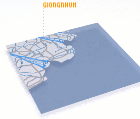 Places with similar names to Giồng Nhum, Vietnam :: Disclaimer :: Information on this page comes without warranty of any kind |
||
|
Where is Giồng Nhum? Elevation and coordinates ::
Latitude (lat): 9°38'0"N Longitude (lon): 106°15'0"E
Elevation (approx.): 1m (map arrows pan, magnifying glasses zoom) |
||
|
Visiting Giồng Nhum? Hotel/Accommodation ::
Book a hotel in Giồng Nhum Travel Guide ::
Buy a travel guide for Vietnam rental cars ::
car rental offers GPS waypoint ::
download a GPX waypoint (PoI) of Giồng Nhum for your GPS receiver
|
||