|
search place name
|
||
Khoa Y Ho (Lai Châu, Vietnam)Khoa Y Ho is a town in the Lai Châu region of Vietnam. An overview map of the region around Khoa Y Ho is displayed below.
regional and 3d topo map of Khoa Y Ho, Vietnam ::

Nearby towns ::
Ðông Pao (1.7km east) //
Bản Po (1.7km east) //
Sang Hai (1.7km west) //
Sang Soui (3.4km east) //
Tou Ko Pin (3.9km south east) //
Bản Yang (4.1km north west) //
Van Mu Na (4.1km north east) //
Na Keu (5.0km north west) //
Then Tao (5.0km north west) //
Na Sai (5.0km north west) //
Bản Hon (5.6km north) //
Seo La Mong (5.5km west) //
Van Thàng (5.5km east) //
Sin Tiay (6.3km south west) //
Trang Phan (6.3km north east) //
Pa Pé (6.9km east) //
Nam Pan (7.1km west) //
Na Hum (7.1km east) //
Nà Phat (7.1km east) //
Nam Nit Ho Tâu (7.6km south east) //
Na Ða (7.6km north east) //
Bản A Pang (8.2km south west) //
Sin Tiay (7.8km south west) //
Chù Kiéo (7.8km south east) //
Coc Pia (8.2km north west) //
Na Bo (8.2km north west) //
Na Khan (7.8km north east) //
Mùng Cấu (7.8km north east) //
Bình Lư (7.8km north east) //
[all distances 'as the bird flies' and approximate] 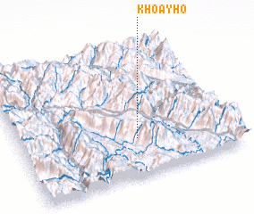 Places with similar names to Khoa Y Ho, Vietnam ::
Disclaimer :: Information on this page comes without warranty of any kind |
||
|
Where is Khoa Y Ho? Elevation and coordinates ::
Latitude (lat): 22°17'0"N Longitude (lon): 103°33'0"E
Elevation (approx.): 934m (map arrows pan, magnifying glasses zoom) |
||
|
Visiting Khoa Y Ho? Hotel/Accommodation ::
Book a hotel in Khoa Y Ho Travel Guide ::
Buy a travel guide for Vietnam rental cars ::
car rental offers GPS waypoint ::
download a GPX waypoint (PoI) of Khoa Y Ho for your GPS receiver
|
||