|
search place name
|
||
Tou Ko Pin (Lai Châu, Vietnam)Tou Ko Pin is a town in the Lai Châu region of Vietnam. An overview map of the region around Tou Ko Pin is displayed below.
regional and 3d topo map of Tou Ko Pin, Vietnam ::

Nearby towns ::
Sang Soui (1.9km north) //
Ðông Pao (2.5km north west) //
Bản Po (2.5km north west) //
Khoa Y Ho (3.9km north west) //
Van Thàng (4.1km north east) //
Pa Pé (3.9km north east) //
Chù Kiéo (3.9km south east) //
Nam Nit Ho Tâu (4.1km south east) //
Na Hum (5.1km north east) //
Nà Phat (5.1km north east) //
Van Mu Na (5.8km north) //
Sang Hai (5.5km west) //
Trang Phan (5.8km north) //
Na Hui (6.3km north east) //
Na Ðon (6.3km north east) //
Kuon Ha (6.5km south east) //
Can Hồ (6.5km south east) //
Mùng Cấu (6.5km north east) //
Bình Lư (6.5km north east) //
Na Khan (6.5km north east) //
Na Ða (7.6km north) //
Na Ko (7.1km east) //
Bản Bô (7.1km east) //
Na Tam (7.1km east) //
Pin Yang (7.1km east) //
Pin Mun (7.1km east) //
Na San (7.6km north east) //
Bản Ko La (7.6km north east) //
Bản Yang (7.6km north west) //
[all distances 'as the bird flies' and approximate] 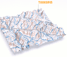 Places with similar names to Tou Ko Pin, Vietnam ::
Disclaimer :: Information on this page comes without warranty of any kind |
||
|
Where is Tou Ko Pin? Elevation and coordinates ::
Latitude (lat): 22°16'0"N Longitude (lon): 103°35'0"E
Elevation (approx.): 1012m (map arrows pan, magnifying glasses zoom) |
||
|
Visiting Tou Ko Pin? Hotel/Accommodation ::
Book a hotel in Tou Ko Pin Travel Guide ::
Buy a travel guide for Vietnam rental cars ::
car rental offers GPS waypoint ::
download a GPX waypoint (PoI) of Tou Ko Pin for your GPS receiver
|
||