|
search place name
|
||
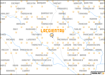
Lạc Giển Tẩu (Cao Bằng, Vietnam)Lạc Giển Tẩu is a town in the Cao Bằng region of Vietnam. An overview map of the region around Lạc Giển Tẩu is displayed below.
regional and 3d topo map of Lạc Giển Tẩu, Vietnam ::
Lạc Giển Tẩu airports ::
The nearest airport is HAN - Hanoi Noibai Intl, located 169.9 km south west of Lạc Giển Tẩu.
Other airports nearby include NNG - Nanning Wuxu (177.1 km east), Nearby towns ::
Lũng Thỏ (1.9km south) //
Lũng Xi (1.9km north) //
Bó Oat (1.7km east) //
Pác Na (2.5km south east) //
Bó Huy (2.5km south west) //
Lũng Các (2.5km north west) //
Bản Tin (3.7km south) //
Lũng Miầu (3.4km west) //
Nà Giu (3.4km west) //
Pác Nà Nưa (3.9km south east) //
Bó Nọi (3.9km south east) //
Bó Luông (3.9km south west) //
Lũng Si (3.9km north east) //
Nà Luông (4.1km south west) //
Kem Sá (4.1km south east) //
Pác Oạc (3.9km north west) //
Bó Cái (4.1km north east) //
Canh Man (4.1km north east) //
Thong Chao (4.1km north west) //
Lảng Luông (5.0km south east) //
Tắc Kha (5.0km north east) //
Lũng Sì (5.0km north west) //
Tẩu Thong (5.1km west) //
Làng My (5.1km east) //
Lũng Hôc (5.1km east) //
Ðồng Ða (5.1km west) //
Thum Ðán (5.6km south) //
Pia Ðeng (5.6km south) //
Lũng Chang (2) (5.5km east) //
[all distances 'as the bird flies' and approximate] 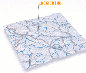 Places with similar names to Lạc Giển Tẩu, Vietnam ::
// Lacajunte (FR)
// La Caujonnet (FR)
Disclaimer :: Information on this page comes without warranty of any kind |
||
|
Where is Lạc Giển Tẩu? Elevation and coordinates ::
Latitude (lat): 22°38'0"N Longitude (lon): 106°27'0"E
Elevation (approx.): 362m (map arrows pan, magnifying glasses zoom) |
||
|
Visiting Lạc Giển Tẩu? Hotel/Accommodation ::
Book a hotel in Lạc Giển Tẩu Travel Guide ::
Buy a travel guide for Vietnam rental cars ::
car rental offers GPS waypoint ::
download a GPX waypoint (PoI) of Lạc Giển Tẩu for your GPS receiver
|
||