|
search place name
|
||
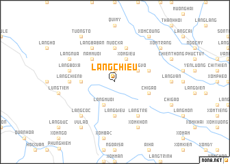
Làng Chiêu (Thanh Hóa, Vietnam)Làng Chiêu is a town in the Thanh Hóa region of Vietnam. An overview map of the region around Làng Chiêu is displayed below.
regional and 3d topo map of Làng Chiêu, Vietnam ::
Làng Chiêu airports ::
The nearest airport is HAN - Hanoi Noibai Intl, located 102.7 km north east of Làng Chiêu.
Nearby towns ::
Làng Son (1.9km north) //
Xóm Giều (4.1km north east) //
Làng Mươi (4.1km south west) //
Làng Vô (3.9km north east) //
Nam Mươi (5.1km north west) //
Làng Cào (5.2km west) //
Nước Ka (5.6km north) //
Làng Diêu (5.6km south) //
Làng Tram (5.5km east) //
Chí Gao (5.5km east) //
Mong Luông (5.8km north) //
Làng Ba Ban (6.6km north west) //
Làng Tre (6.6km south east) //
Làng Chiên (1) (6.9km west) //
Làng Bô Xa (7.2km west) //
Làng Coc (7.6km south west) //
Làng Nua (7.9km north west) //
Xóm Khon (8.2km south east) //
Xóm Coung (9.1km north east) //
Tuông To (9.1km north west) //
Xóm Trang (8.9km north east) //
Vũ Lao (9.1km south west) //
[all distances 'as the bird flies' and approximate] 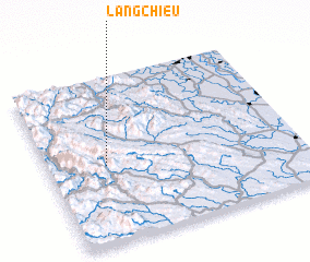 Places with similar names to Làng Chiêu, Vietnam ::
// Łańcuchów (PL)
// Lankaičiai (LT)
// Lenkčiai (LT)
// Linkaičiai (LT)
// Linkaičiai (LT)
// Linkaičiai (LT)
// Linkaičiai (LT)
// Linkaučiai (LT)
// Lāngātia (BD)
// Lingshi (BT)
Disclaimer :: Information on this page comes without warranty of any kind |
||
|
Where is Làng Chiêu? Elevation and coordinates ::
Latitude (lat): 20°28'0"N Longitude (lon): 105°14'0"E
Elevation (approx.): 501m (map arrows pan, magnifying glasses zoom) |
||
|
Visiting Làng Chiêu? Hotel/Accommodation ::
Book a hotel in Làng Chiêu Travel Guide ::
Buy a travel guide for Vietnam rental cars ::
car rental offers GPS waypoint ::
download a GPX waypoint (PoI) of Làng Chiêu for your GPS receiver
|
||