|
search place name
|
||
Làng Mãnh (Thanh Hóa, Vietnam)Làng Mãnh is a town in the Thanh Hóa region of Vietnam. An overview map of the region around Làng Mãnh is displayed below.
regional and 3d topo map of Làng Mãnh, Vietnam ::

Làng Mãnh airports ::
The nearest airport is HAN - Hanoi Noibai Intl, located 183.1 km north of Làng Mãnh.
Nearby towns ::
Làng Thê (1.9km south) //
Xóm Quốc (1.9km north) //
Câm Tchang (1.7km west) //
Xóm Ca (2.5km north east) //
Làng Manh (2.5km north west) //
Làng Cò Hat (4.0km south east) //
Xóm Ðai (4.1km north west) //
Câm Bái (4.0km north west) //
Làng Ban (4.0km north west) //
Làng Tam (4.0km north west) //
Trinh Lư (5.1km north west) //
Làng Suối (5.6km east) //
Làng Pha Rinh (5.8km south) //
Ðồng Phụng (6.6km north east) //
Làng Huân (6.4km north west) //
Bản Cam (6.6km north west) //
Lâm Lư (7.4km north) //
Tai Bôc (7.6km north) //
Kẻ Dang (7.6km north west) //
Làng Ðang (7.6km north east) //
Làng Ky Phá (8.2km south east) //
Làng Bỏ (7.9km north east) //
Kẻ Quân (2) (7.9km north west) //
Xóm Cốc (8.9km north east) //
Ðồng San (9.1km north west) //
Na Mai (9.1km north west) //
Tại Bon (9.1km north east) //
Hon Dương (9.1km north east) //
[all distances 'as the bird flies' and approximate] 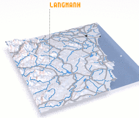 Places with similar names to Làng Mãnh, Vietnam ::
Disclaimer :: Information on this page comes without warranty of any kind |
||
|
Where is Làng Mãnh? Elevation and coordinates ::
Latitude (lat): 19°38'0"N Longitude (lon): 105°19'0"E
Elevation (approx.): 115m (map arrows pan, magnifying glasses zoom) |
||
|
Visiting Làng Mãnh? Hotel/Accommodation ::
Book a hotel in Làng Mãnh Travel Guide ::
Buy a travel guide for Vietnam rental cars ::
car rental offers GPS waypoint ::
download a GPX waypoint (PoI) of Làng Mãnh for your GPS receiver
|
||